

Red Sea research basis for further search for Resources
Bryndís Brandsdóttir, a geophysicist at the Science Institute of the University of Iceland is among earth scientists who study the ocean floor in order to unravel millions of years of geological history.
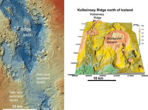
In the summer of 2016, Bryndís participated in a research expedition to map and sample the northernmost part of the slow-spreading Kolbeinsey Ridge, over 400 km north of Iceland. The expedition was led by Isobel Yeo and funded by the GEOMAR research institute in Kiel, Germany. Bryndís worked with Nico Augustin on multibeam mapping the volcanic seafloor on board the German research vessel Poseidon. Nico has also been conducting geophysical work and mapping of the slow-spreading ridge within the Red Sea, in collaboration with other scientists at GEOMAR and King Abullah University in Saudi Arabia.
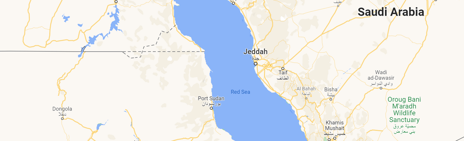
The Red Sea is 2,250 long but only 355 km where it is widest, narrowing northwards. Not only is it one of the most important marine traffic routes of modern world trade but its tectonic evolution and seafloor age have been puzzling geoscientists for decades. How far north the rifting between Africa and Arabia is active, has long been debated says the geophysicist Bryndís Brandsdóttir.
Nico had been developing a tectonic model of the Red Sea but had not included the local earthquake data. Bryndís became interested in the research and using European and Amercan databases compiled a map of the seismic activity within the Red Sea to compare it with the seismicity along the Kolbeinsey ridge and Iceland.
The volcanic formations along the Red Sea reveal an interesting history of divergence, and ocean spreading comparable to what happened in the North Atlantic Ocean 55 million years ago; when the Aegir Ridge was formed as Greenland and Norway started drifting apart.
“Our model of the Red Sea is based on new geochemical analysis, a more precise geological map of the sea floor, as well as more comprehensive geophysical data," says Bryndís. Co-interpretation of gravimetric and seismic data reflects tectonic movements in the northern Red Sea over the last 13 million years. We also compared the gravimetry data with other divergent ridges, including the Reykjanes Ridge south of Iceland and the Aegir Ridge between Iceland and Norway. Rock samples from the sea floor have further confirmed the existence of an oceanic crust, similar to the Mid-Atlantic ridge.
“Our results show that albeit still narrow, a continuous oceanic ridge lies beneath the northern Red Sea and this ridge has been spreading Africa and the Arabian Peninsula apart for about 13 million years. The spreading ridge in the northern Red Sea is covered with thick salt and sedimentary layers that have confused scientists and caused disagreement on the area's geology."
Bryndís says that the volcanic formations along the Red Sea reveal an interesting history of divergence, and ocean spreading comparable to what happened in the North Atlantic Ocean 55 million years ago; when the Aegir Ridge was formed as Greenland and Norway started drifting apart.
