Gregory P. De Pascale, associate professor of geology at the University of Iceland, has published an article in the renowned science journal Tectonics demonstrating how remote sensing techniques can be used to see the Earth's surface beneath the dense rainforest in Chile. This method was developed to detect surface changes in areas where thick vegetation makes traditional geological research extremely challenging. De Pascale’s co-author is Sebastian Perroud, a structural geologist at the University of Chile.
Remote sensing, as applied in their study, involves capturing digital imagery from significant altitudes—using drones, aircraft, and satellites—and processing this data to extract detailed information about the Earth's surface.
By gathering data using remote sensing techniques based on LiDAR (Light Detection and Ranging), the researchers were able to filter out dense vegetation and effectively reveal the bare ground surface. LiDAR works by emitting laser pulses at specific wavelengths toward the rainforest floor and recording the reflected signals.
This approach revealed fault lines and landform changes caused by tectonic activity, specifically along the Chile Ridge, a tectonic feature geologically similar to Iceland’s Reykjanes Ridge. The Reykjanes Ridge extends into the Atlantic Ocean and marks the boundary between the Eurasian and North American tectonic plates.
University of Iceland scientists discovers tectonic changes in Chile
Remote sensing is becoming an increasingly vital field of science globally, and the University of Iceland has been at the forefront worldwide. The use of remote sensing is increasing both in Iceland and other places worldwide to monitor and predict volcanic unrest and activity that may lead to eruptions.
However, according to Gregory, this study used remote sensing to detect land changes through a novel approach.
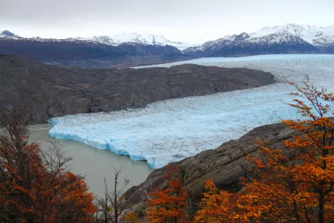
The Patagonian Andes of Chile is the only place on Earth where the ocean is spreading apart and forming new oceanic crust, and is being subducted underneath a continent.
“This subduction of the Chile Ridge, is oblique, and leads to strike slip movement of a major fault, the Liquiñe-Ofqui. Because of abundant rainforest, it is difficult to see how this fault interacts with and modifies the landscape,” says Gregory.