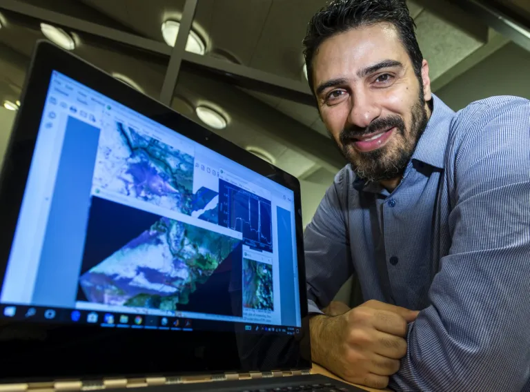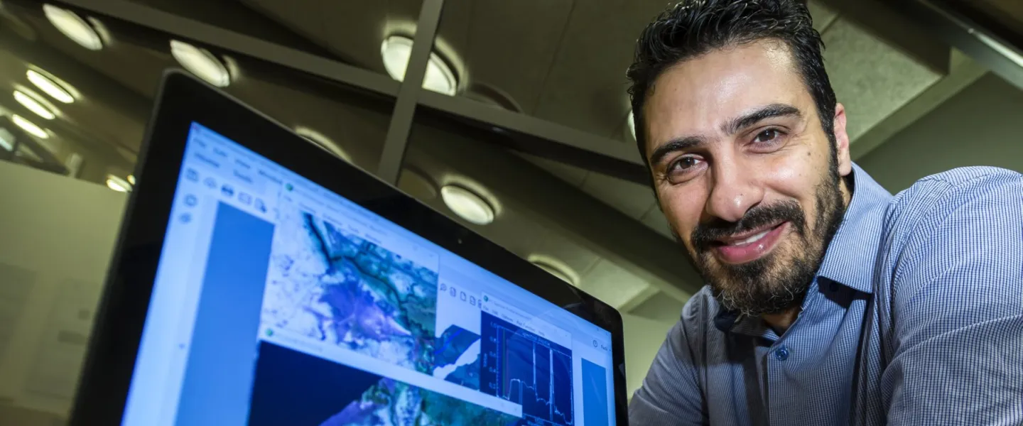
Fadi Kizel, PostDoc at the Engineering Research Institute
“Iceland is exposed to rapid and dynamic landscape changes caused by natural processes and man-made activities, which impact and challenge the socio-economic situation of the country. Fast and reliable mapping and monitoring techniques are needed on a big spatial scale with a high temporal resolution “, says Fadi Kizel, Post Doc in electrical- and computer engineering who participates in the excellence project “Environmental Mapping and Monitoring of Iceland by Remote Sensing(EMMIRS),” the project’s goal is to establish a remote sensing centre at the University of Iceland.
Remote sensing concerns digital photography from airplanes and satellites at various resolutions, and extraction from them a variety of data concerning the Earth’s surface. Processing such data is not a simple matter and therefore methods have been developed by the University’s scientists alongside the collection and work on remote sensing data.