Language skills
Programme length
Three years - 180 ECTS
Study mode
Face-to-face learning
Application status
International students:
Students with Icelandic or Nordic citizenship:
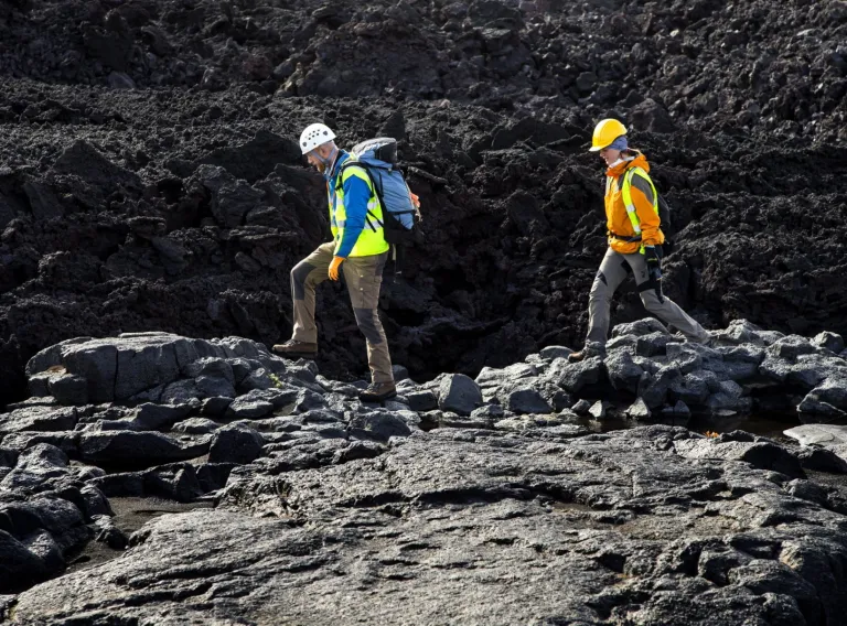
- Do you want to understand how to harness energy and natural resources?
- Do you want to know how the earth was formed, what plate tectonics are or what causes earthquakes?
- Do you want to tackle diverse projects under the guidance of Iceland's leading geologists?
- Do you enjoy collecting data, measuring and calculating?
- Do you want a diverse selection of courses that suit your interests?
- Do you want to open up future opportunities in challenging careers?
The undergraduate programme is focused on providing students with a thorough overview of the earth sciences.
Students will acquire a solid theoretical foundation in the basic subjects, such as:
- physics
- chemistry
- mathematics
Course topics include:
- Stratigraphy
- Mineralogy and petrology
- Geochemistry of rock and water
- Volcanology
- Palaeoclimatology
- Earth evolution
- Remote sensing
- Glaciology
Icelandic matriculation examination (stúdentspróf) or a comparable qualification including a minimum number of credits (fein) in the following subjects (e for the old studentsprof): Mathematics 30 ein, science 40 ein of which 10 ein should be in physics and 10 ein in chemistry.
Good knowledge of both Icelandic and English is indispensable. Most courses in the undergraduate program are taught in Icelandic.
Applicants with qualifications from a school abroad who plan to enrol in an undergraduate programme taught in Icelandic at the faculty must also pass a special entrance exam in Icelandic, in accordance with Article 1.
180 ECTS credits have to be completed for the qualification, organized as a three year programme. Courses totalling 127,5 ECTS credits are compulsory.
Programme structure
Check below to see how the programme is structured.
This programme does not offer specialisations.
- First year
- Fall
- Mathematical Analysis I
- Mathematics N
- Earth Dynamics
- Physics B
- General Chemistry 1
- Chemistry Laboratory 1a
- Tutor classes in Earth Science
- Spring 1
- Earth Surface processes
- Mineralogy
- General Geophysics
- Statistics and Data Analysis
First year | Fall
Mathematical Analysis I (STÆ104G)
Restricted elective course, conditions apply
6 ECTS, credits
Course Description
This is a foundational course in single variable calculus. The prerequisites are high school courses on algebra, trigonometry. derivatives, and integrals. The course aims to create a foundation for understanding of subjects such as natural and physical sciences, engineering, economics, and computer science. Topics of the course include the following:
- Real numbers.
- Limits and continuous functions.
- Differentiable functions, rules for derivatives, derivatives of higher order, applications of differential calculus (extremal value problems, linear approximation).
- Transcendental functions.
- Mean value theorem, theorems of l'Hôpital and Taylor.
- Integration, the definite integral and rules/techniques of integration, primitives, improper integrals.
- Fundamental theorem of calculus.
- Applications of integral calculus: Arc length, area, volume, centroids.
- Ordinary differential equations: First-order separable and homogeneous differential equations, first-order linear equations, second-order linear equations with constant coefficients.
- Sequences and series, convergence tests.
- Power series, Taylor series.
Language of instruction: Icelandic
Face-to-face learning
First year | Fall
Mathematics N (STÆ108G)
Restricted elective course, conditions apply
6 ECTS, credits
Course Description
Course description: The fundamental concepts of calculus will be discussed. Subjects: Limits and continuous functions. Differentiable functions, rules for derivatives, derivatives of higher order, antiderivatives. Applications of differential calculus: Extremal value problems, linear approximation. The main functions in calculus: logarithms, exponential functions and trigonometric functions. The mean value theorem. Integration: The definite integral and rules of integration. The fundamental theorem of calculus. Techniques of integration, improper integrals. Series and sequences. Ordinary differential equations. Vectors and matrix calculations.
Language of instruction: Icelandic
Face-to-face learning
First year | Fall
Earth Dynamics (JAR101G)
A mandatory (required) course for the programme
7,5 ECTS, credits
Course Description
- The course emphasizes geological processes as a consequence of endogenic processes.
- Main topics covered in the course:
- The main features of the Earth’s internal structure, with emphasis on its layering and the properties of individual layers.
- Early hypotheses about continental drift and their development leading to plate tectonics theory, with emphasis on why and how the relative positions of plates and continents are constantly changing.
- The fundamentals of mineral and rock formation and metamorphism.
- Volcanism: causes, distribution, and hazards, with special reference to Iceland.
- Causes of earthquakes and their distribution, different types and behavior of seismic waves, and how this knowledge can be used, for example, to locate and assess the size of earthquakes.
- Structural geology: faults, folds, mountain building, and associated forces.
- Geological time and dating methods, and the geologic time scale, i.e., the arrangement of strata in time and space.
- In addition to general discussion of the course content, special emphasis is placed on the geological and geohistorical formation and position of Iceland.
Teaching arrangement
The course is 7.5 ECTS and spans 14 weeks. Course content is presented in lectures, selected reading material, practical exercises, and three field trips.
- Lectures are tvice a week inaddtion to on excercise class.
- Field trips: Day trips, usually during the first 4–5 weeks of the semester.Attendance is mandatory. Note field trips can be on weekends.
- Practical exercises: Conducted in classrooms and around the University. Attendance is mandatory.
- Weekly multiple-choice quizzes on textbook chapters.
Language of instruction: Icelandic
Face-to-face learning
Attendance required in class
First year | Fall
Physics B (EÐL101G)
A mandatory (required) course for the programme
8 ECTS, credits
Course Description
Subject Matter: Newtonian Mechanics for particles and rigid bodies. Dynamical variables and conservation laws. Elements of Fluid Mechanics. Thermodynamics. Elements of Electromagnetism. Laboratory exercises in which students are trained in handling physical instruments, performing measurements and interpreting the data.
The course is thaught in English or Icelandic according to the needs of the students.
Language of instruction: Icelandic
Face-to-face learning
First year | Fall
General Chemistry 1 (EFN108G)
A mandatory (required) course for the programme
6 ECTS, credits
Course Description
The basis of the atomic theory. Stoichiometry. Types of chemical reactions and solution stoichiometry. Properties of gases. Chemical equilibrium. Acids and bases. Applications of aqueous equilibria. Chemical thermodynamics. Enthropy, free energy and equilibrium. Electrochemistry. Chemical kinetics. Physical properties of solutions.
Language of instruction: Icelandic
Face-to-face learning
First year | Fall
Chemistry Laboratory 1a (EFN110G)
A mandatory (required) course for the programme
2 ECTS, credits
Course Description
Molar volume of gases, thermochemistry, reaction enthalpies and Hesse's law, Rate of chemical reactions, decomposition of hydrogen peroxide, reaction reversibility and Le Chatelier's principle, determination of acid ionization constant with potentiometric titration, determination of equilibrium constant with absorbtion measurements.
Language of instruction: Icelandic
Face-to-face learning
Attendance required in class
First year | Fall
Tutor classes in Earth Science (JAR045G)
Free elective course within the programme
0 ECTS, credits
Course Description
Tutor classes for Earth Science students
Language of instruction: Icelandic
Face-to-face learning
First year | Spring 1
Earth Surface processes (JAR202G)
A mandatory (required) course for the programme
7,5 ECTS, credits
Course Description
The main topics covered in the course are:
- Fundamentals of sedimentology, with emphasis on changes in grain size, grain-size distribution, texture, and grain shape during transport by water, glaciers, and wind.
- The Earth’s hydrological cycle and its role in weathering, sediment transport, and sediment accumulation.
- Running water as the most important agent shaping terrestrial landscapes, both in terms of erosion and sediment transport.
- Earth’s coastlines: interactions at the boundary between land and sea, continuous coastal change, and the factors controlling coastal development.
- Groundwater: its role in landscape formation, its importance for drinking water supply, and methods for protecting this resource.
- Atmospheric circulation and its influence on the distribution of precipitation and the extent of arid regions.
- Major erosion and sedimentary processes and the landforms they create in Iceland.
- Glaciers: formation, variability in size, and the glacial history of the last glacial period.
- Inorganic and organic natural resources: formation, distribution, extraction, use, disposal, renewal, and recycling.
- Linking theoretical concepts to Iceland, through discussion of comparable geological phenomena found in Iceland.
Teaching arrangement
The course is worth 7.5 ECTS credits and runs for 14 weeks. Course material is presented through lectures, discussion sessions, selected readings, and a field excursion.
- Lectures are held twice a week.
- The field excursion is a five-day trip to South Iceland and the Vestmannaeyjar islands. The excursion takes place immediately after the final spring examination day and participation is mandatory. The University of Iceland covers accommodation and transportation costs, while students are responsible for their own meals.
- Students complete weekly multiple-choice quizzes based on textbook chapters and scientific articles.
Language of instruction: Icelandic
Face-to-face learning
Attendance required in class
First year | Spring 1
Mineralogy (JAR211G)
A mandatory (required) course for the programme
7,5 ECTS, credits
Course Description
Introduction to crystallography and mineralogy. Lectures cover four main fields: 1) Crystallography; 2) Crystal optics; 3) Crystal chemistry; 4) Systematic mineralogy where the students get familiar with the chemical composition and physical properties of the most important rock-forming minerals.
Laboratory work will include exercises with crystal models and optical microscope as well as determination of minerals in hand specimen.
During the course, group projects will also be issued. These projects are optional and the groups present their results at the end of the semester.
Language of instruction: English
Face-to-face learning
Attendance required in class
First year | Spring 1
General Geophysics (JEÐ201G)
A mandatory (required) course for the programme
7,5 ECTS, credits
Course Description
An introduction to the physics of the Earth. Origin and age of the Earth. Dating with radioactive elements. Gravity, shape and rotation of the Earth, the geomagnetic field, magnetic anomalies, palaeomagnetism, electric conductivity. Earthquakes, seismograph and seismic waves. Layered structure of the Earth, heat transport and the internal heat of the Earth. Geophysical research in Iceland.
Practicals include solving problems set for each week and exercises in the use of geophysical instruments. Students write one essay on a selected topic in geophysics.
Language of instruction: Icelandic
Face-to-face learning
First year | Spring 1
Statistics and Data Analysis (STÆ209G)
A mandatory (required) course for the programme
8 ECTS, credits
Course Description
At the beginning of the course some main statistical concepts are introduced, such as population, sample, variable and randomness. Various descriptive statistics are introduced, as well as basic graphical representations. Fundamentals of probability theory are introduced, as well as the most common probability distributions. The rest of the course deals with inferential statistics where hypotheses tests and confidence intervals for means, variance and proportions are covered as well a analysis of variance (ANOVA) and simple linear regression. Students will learn how to apply the above mentioned methods in the statistical software R.
Language of instruction: Icelandic
Face-to-face learning
- Second year
- Fall
- Tectonics
- Sedimentology and sedimentary rocks
- Igneous Petrology
- Spring 1
- Not taught this semesterEarth evolution
- Remote sensing and geographical information systems in geological observations
- General Oceanography 1
- General Geochemistry
- Field Excursion Abroad
Second year | Fall
Tectonics (JAR315G)
A mandatory (required) course for the programme
7,5 ECTS, credits
Course Description
Tectonic motions control the nature of the planet we inhabit and the location of continents, mountain ranges, volcanoes, where earthquakes occur and even are important for controlling the Earth's climate. Structural geology and crustal movements in the world, with special emphasis on movements in Iceland. This course introduces the techniques of structural geology through a survey of the mechanics of rock deformation, a survey of the features and geometries of faults and folds, and techniques of strain analysis. Regional structural geology and tectonics are introduced. The subject of the course is active tectonic movements and how this is manifested and recorded in the geological record with emphasis on processes currently active in Iceland. Lectures will be complimented with fieldwork and supportive examples will be given from a global perspective (e.g. compressional tectonics from the Andes and other extensional environments like the East Africa Rift). Methods to describe these processes will be taught and evaluated. Structural geology concepts including elastic, ductile, and brittle behavior of rocks in the crust and mantle will be discussed and discontinuities and brittle fracturing will be addressed. Plate tectonics, plate velocity models, both relative and absolute. Earthquakes. Plate boundary deformation including strike-slip, extensional, and compressive regimes with rifts and rifting structures and folds in addition to mountain building. (If time permits: microstructures, post-rifting and post-seismic movements, Isostasy, vertical crustal movements and sea level, and structural level. measuring crustal movements, GPS-geodesy, levelling, and analysis of seismic stratigraphy (i.e. active source seismic reflection and refraction profiles). Fieldwork will focus on discontinuity analysis and characterisation through a combination of exposure mapping with structural observations coupled with digital elevation (DEMs) model collection using drones and associated analysis to create a coherent assessment of active faults in Southwestern Iceland. Lectures are required as content in the lectures will be tested. Students visiting from abroad in Geology and Geophysics are encouraged to participate in this class as this will be held in English and provide excellent insight into the Iceland Tectonic and Plate Boundary system.
Language of instruction: English
Face-to-face learning
Attendance required in class
Second year | Fall
Sedimentology and sedimentary rocks (JAR308G)
A mandatory (required) course for the programme
7,5 ECTS, credits
Course Description
The course will focus on the study of sediments and sedimentary rocks, erosion, transport processes and accumulation of sediments, and sedimentary facies and facies associations. Emphasis is placed on linking practical work and lectures. Exercises will be conducted in the field and in the laboratory. Students will be taught to log sedimentary sections and to map sediments and sedimentary rocks, to take samples and perform basic sedimentological analyses of physical properties in the lab.
Language of instruction: English
Face-to-face learning
Attendance required in class
Second year | Fall
Igneous Petrology (JAR312G)
A mandatory (required) course for the programme
7,5 ECTS, credits
Course Description
The course aims to provide an overview of modern Igneous Petrology – methods, practices and problems. This includes classification of igneous rocks and their relationship to tectonic environment; evolution of igneous rocks in the light of phase diagrams and trace elements; petrological lessons from intrusions, oceanic rifts, oceanic islands, and continental regions; and the petrology of Iceland: volcanic systems, magma series and their relationship to volcano-tectonics.
Laboratory exercises will cover mineralogical and chemical classification of igneous rocks, exercises with phase diagrams and trace element systematics, mineral and rock identification in the petrological microscope and interpretation of chemical data. During this course, students will work on independent petrology projects, where they get familiar with scanning electron microscopy and electron microprobe analyses.
Language of instruction: English
Face-to-face learning
Prerequisites
Attendance required in class
Not taught this semester
Second year | Spring 1
Earth evolution (JAR048G)
A mandatory (required) course for the programme
7,5 ECTS, credits
Course Description
Geological and environmental history of the Earth from the Precambrian, Palaeozoic, Mesozoic, and Cenozoic to present. Basic principles of stratigraphy, time and geological age determinations. Plate tectonics and supercontinents, regional stratigraphy, Wilson Cycle, climate history and evolution of life. Fossils, basic principles of paleontology, avenues of evolution and mass extinctions. Fossils and environment. Icehouse and greenhouse Earth and climate change in general. The geological history of Earth during the Cenozoic Era in general, and with special emphasis on the opening of the North Atlantic Ocean and the location that will eventually become Iceland. Gradual climate cooling during Cenozoic and implications. Fossil evidence on Cenozoic evolution of life, with emphasis on evolution of mammals in general and primates and Man in particular. This includes topics like evolution of environments, continental rift and mountain building, evolution of life, speciation, biodiversity and mass extinctions. Quaternary glacial- and climate history.
Language of instruction: English
Face-to-face learning
Prerequisites
Second year | Spring 1
Remote sensing and geographical information systems in geological observations (JAR420G)
A mandatory (required) course for the programme
7,5 ECTS, credits
Course Description
Purpose: For geology students to obtain scientific background and skills in using remote sensing, cartography and GIS in projects and research, and to present their findings in reports, with maps and GIS databases. Preparation for geological fieldwork.
Fundamentals of Remote Sensing: Plancks, Stefan-Boltzman, Wien. Electromagnetic waves and interaction with the surface of the Earth. Atmospheric influence on EM radiation. Geometric and radiometric resolution. Scanners and satellite orbits. Interpretation of aerial photographs and satellite images for geological purposes. Image processing methods. Classification and analysis of geological features and processes. Real-time estimation of natural hazards as well as longer term environmental changes. Data reliability and data merging.
Fundamentals of Geographical Information Systems: Vector data, raster and attribute tables. How GIS can be utilized in geological projects and observations. Various analyzing methods. Topology. Geological mapping and GIS databases. Work and geological analysis with structural maps.
Weekly lectures and projects in a computer lab. Two short field sessions.
Weekly projects: 70% Independent project, presentation and GIS databases: 30%
Students have to pass all parts of the course.
Language of instruction: Icelandic/English
Face-to-face learning
Attendance required in class
Second year | Spring 1
General Oceanography 1 (JAR414M)
A mandatory (required) course for the programme
7,5 ECTS, credits
Course Description
The aim is to introduce students to the disciplines of general oceanography, in particular marine geological, physical and chemical oceanography. To understand how the interactions of processes shape the characteristics of different ocean regions.
The course covers the distribution of land and water, the world oceans and their geomorphology. Instruments and techniques in oceanographic observations. Physical properties of sea water. Energy and water budgets. Distribution of properties in relation to turbulence and diffusion. Introductory dynamical oceanography. Chemical oceanography: Geochemical balance, major and minor elements, dissolved gases. Biogeochemical cycles. Biological processes in relation to the physical and chemical environment. Oceanography of the North Atlantic and Icelandic waters
Language of instruction: English
Face-to-face learning
Attendance required in class
Second year | Spring 1
General Geochemistry (JAR419G)
A mandatory (required) course for the programme
7,5 ECTS, credits
Course Description
In this course the principles of geochemistry will be introduced, including the distribution of the elements on Earth, various phase diagrams, thermodynamics and water solutions. Also covered is nuclear fusion, the origin of the solar system, distribution of trace elements, stable and radiogenic isotopes, and how these are used in geoscience research.
Language of instruction: Icelandic/English
Face-to-face learning
Second year | Spring 1
Field Excursion Abroad (JAR615G)
Free elective course within the programme
5 ECTS, credits
Course Description
The field excursion abroad has the aim to create first-hand experience with respect to the recognition of rock types which do not occur in Iceland and which typically have relatetively high stratigraphic ages (mostly Devonian to Eocene, ca. 400-40 Ma). The excursion will lead us to the "classical square mile in geology" at the northern margin of the Harz Mountains in central Germany. It will encompass the Harz Mountains and its northern foreland, a region listed as one of six UNESCO Global Geoparks in Germany since 2005 (Geopark Harz - Braunschweiger Land - Ostfalen). We will visit natural exposures, old and working quarries, and mines including the visitor mine of Rammelsberg in Goslar which became UNESCO World Heritage Site in 1992.
Igneous and metamorphic rocks such as granites and gneisses, and sedimentary rocks such as sandstones, shales and limestones including reef carbonates will be examined in the field. Karst features and speleothem formation will be explored. Massive Permian rock-salt deposits will be investigated in a mine 670 m below the surface. Eocene lignite deposits will be visited.
This course is only intended for Icelandic undergraduate students.
Students cover all expenses for travel and accommodation including entrance tickets for mines, caves and museum exhibitions apart from the rental of a bus.
The upcoming field trip will be from May 18 to 27, 2026. A following fied trip will be conducted in May 2028.
Required equipment:
Slopes can be covered by scree material, and hikes of 5-15 km can be included. Thus, robust shoes are required. In addition, students should bring:
- a field book and pen(s),
- a geological compass,
- a hand lens,
- a scale for photos,
- safety goggles,
- and possibly work gloves.
Temperatures in May can be relatively warm and sun protection (sunscreen, hat, long sleeve t-shirts, trousers) might be useful. Long trousers are also recommended to avoid tick bites.
Language of instruction: Icelandic
Face-to-face learning
The course is taught if the specified conditions are met
Prerequisites
- Third year
- Fall
- Geological history of Iceland
- Geological Mapping
- Thermodynamics and Introduction to Statistical Mechanics V
- Not taught this semesterPaleolimnology
- Computer Science 1a
- Geophysical Exploration B
- Geothermal energy
- BS-Project in Geology
- Not taught this semesterSeismology
- Volcanology
- Groundwater Hydrology
- Not taught this semesterGeophysical Exploration
- Continuum Mechanics and Heat Transfer
- Energy and resources of the Earth
- Not taught this semesterQuaternary Environments
- Spring 1
- General Chemistry 2
- BS-Project in Geology
- Geology for Engineers
- Analytical Chemistry
- Chemistry Laboratory 2
- Field Excursion Abroad
- Metamorphism, hydrothermal alteration and weathering
- Not taught this semesterGlaciology
- Advanced petrology
- Not taught this semesterApplied Geology
- Not taught this semesterGlacial Geology
- Glaciers and glacier landscapes
Third year | Fall
Geological history of Iceland (JAR047G)
A mandatory (required) course for the programme
7,5 ECTS, credits
Course Description
The aim of the course is threefold:
- to identify which geological observations and methods are used to decipher Iceland's geological history,
- to analyze the limitations of methods and data
- to identify and explain with examples the main events in Iceland's geological history and the associated geological processes at work.
Topics covered include the opening of the North Atlantic, the formation of tectonic plate boundaries (the Reykjanes, Kolbeinsey and Ægir ridges). The interaction of the Iceland hotspot with the tectonic plates, rift jumps and the formation of the igneous rock provinces of the North Atlantic will be discussed in the context of the formation of Iceland's bedrock. In addition, the course will address Iceland's past climate, environmental and glacial history, as well as geomorphological evolution. Discussion on the geological history of Iceland is placed in the context with the global conditions that existed when Iceland was being formed and shaped.
Teaching arrangement: This is a 7.5 ECTS course running over 14 weeks. Course material is delivered through lectures, selected readings, and three field trips. Lectures take place once per week (2 × 80 minutes). Attendance on field trips is mandatory.
Teaching statement: To achieve good results in the course, students need to actively participate in lectures and project work. Students gain knowledge in lectures, but it is necessary to do exercises and participate in field trips to increase understanding of concepts and train methods. Teachers will make course concepts and content accessible, but students are expected to study independently and ask questions if something is unclear. Teachers emphasize that students participate in the course evaluation if something needs to be improved. A midterm survey will be reviewed with the students.
Language of instruction: English
Face-to-face learning
The course is taught if the specified conditions are met
Prerequisites
Attendance required in class
Third year | Fall
Geological Mapping (JAR513G)
A mandatory (required) course for the programme
7,5 ECTS, credits
Course Description
This is a course undertaken over two weeks in summer each year in August (dates to be decided), where the students are trained in basic methods of field observations and geological mapping.
Field work = two weeks (10 days). The first five days will be spent learning relevant field methods and techniques and the following five days will be spent mapping the geology within assigned areas.
It is also anticipated that the students spend up to 100 hours on a final report on the field observations and measurements undertaken during the field component of the course to be handed in by the end of the seventh week of the fall semester.
Language of instruction: Icelandic
Face-to-face learning
Attendance required in class
Third year | Fall
Thermodynamics and Introduction to Statistical Mechanics V (EFN315G)
Free elective course within the programme
6 ECTS, credits
Course Description
Basic principles and mathematical methods in thermodynamics,
laws of thermodynamics, state functions, Maxwell relations, equilibrium, phase transitions, quantum statistical mechanics, ideal and real gases, specific heat, rate theory.
Language of instruction: Icelandic
Face-to-face learning
Not taught this semester
Third year | Fall
Paleolimnology (JAR515M)
Free elective course within the programme
7,5 ECTS, credits
Course Description
The paleolimnology seminar provides an introduction to the study of lake sediments, commonly used methods, and inferences derived from lake-sediment analyses. Characteristics of lake sediments, abiotic and biotic components of lake sediments, and the response of lake systems to environmental and climate change will be discussed. Practical analyses include initial lake-sediment description, smear-slide analysis, common sample-treatment methods, and the separation, documentation and identification of macro- and microscopic organic remains. Paleoecological and paleoenvironmental reconstructions based on lake sediments will be demonstrated. Paleolimnological approaches are invaluable for the assessment, monitoring and restoration of aquatic ecosystems. The course is taught during the last seven weeks of the semester.
Language of instruction: English
Face-to-face learning
The course is taught if the specified conditions are met
Prerequisites
Attendance required in class
Course taught second half of the semester
Third year | Fall
Computer Science 1a (TÖL105G)
Free elective course within the programme
6 ECTS, credits
Course Description
Programming in Python (for computations in engineering and science): Main commands and statements (computations, control statements, in- and output), definition and execution of functions, datatypes (numbers, matrices, strings, logical values, records), operations and built-in functions, array and matrix computation, file processing, statistics, graphics. Object-oriented programming: classes, objects, constructors and methods. Concepts associated with design and construction of program systems: Programming environment and practices, design and documentation of function and subroutine libraries, debugging and testing of programmes.
Language of instruction: Icelandic
Face-to-face learning
Third year | Fall
Geophysical Exploration B (JEÐ507M)
Free elective course within the programme
7,5 ECTS, credits
Course Description
The course is aimed at students that have already taken a first course in geophysics and have basic knowledge of geophysical exploration and its application. The course is split in two parts:
- a) Four to five days of field work at the beginning of autumn term. Several geophysical methods applied to practical problems.
- b) Geophysical exploration methods and their application in the search for energy resources and minerals. Theoretical basis, instruments, measurement procedures, data processing and interpretation. Seismic reflection and refraction, gravity, magnetics, electrical methods, borehole logging. Practical work includes computation excises and model experiments. Interpretation and preparation of report on field work done at beginning of course.
Language of instruction: English
Face-to-face learning
Attendance required in class
Third year | Fall
Geothermal energy (JAR508M)
Free elective course within the programme
7,5 ECTS, credits
Course Description
Heat budget of the Earth, heat transport to the Earth´s surface. Geothermal systems and their structure, renewability of geothermal systems, methodology in geothermal development, estimation of resource size, fluid origin and chemistry, water-rock interaction, environmental impact of utilization, well testing and well data integration. The course is taught during 7-week period in the first part of the fall semester. It consists of lectures, practical, student lectures, student posters, essay and exams. The course is taught in English.
Language of instruction: English
Face-to-face learning
Attendance required in class
Course taught first half of the semester
Third year | Fall
BS-Project in Geology (JAR265L)
Free elective course within the programme
0 ECTS, credits
Course Description
Students work on the BS-project under the supervision of a teacher.
Language of instruction: Icelandic/English
Self-study
Part of the total project/thesis credits
Not taught this semester
Third year | Fall
Seismology (JEÐ505M)
Free elective course within the programme
7,5 ECTS, credits
Course Description
Stress and strain tensors, wave-equations for P- and S-waves. Body waves and guided waves. Seismic waves: P-, S-, Rayleigh- and Love-waves. Free oscillations of the Earth. Seismographs, principles and properties. Sources of earthquakes: Focal mechanisms, seismic moment, magnitude scales, energy, frequency spectrum, intensity. Distribution of earthquakes and depths, geological framework. Seismic waves and the internal structure of the Earth.
The course is either tought in a traditional way (lectures, exercises, projects) or as a reading course where the students read textbooks and give a written or oral account of their studies.
Language of instruction: English
Face-to-face learning
The course is taught if the specified conditions are met
Prerequisites
Course taught second half of the semester
Third year | Fall
Volcanology (JAR514M)
Free elective course within the programme
7,5 ECTS, credits
Course Description
Volcanic eruptions are one of the principal forces that affect and modify the Earth’s surface. The resulting volatile emissions not only replenish and maintain our atmosphere, but are also known to have significant impact atmospheric properties and its circulation. Volcanism has also played a critical role in forming a significant fraction of mineral resources currently exploited by man. As such, volcanic phenomena influence directly or indirectly many (if not all) sub-disciplines of Earth Sciences. Consequently, a basic understanding of how volcanoes work and how they contribute to the earth system cycles is a valuable knowledge to any student in geosciences.
The basic principles of volcanology are covered in this course including the journey of magma from source to surface plus the general processes that control eruptions and dispersal of erupted products. We also cover the principles of eruption monitoring as well as volcano-climate.
Practical sessions will be held weekly and are aimed at solving problems via calculations, data analysis and arguments. One field trip to Reykjanes.
Language of instruction: English
Face-to-face learning
Attendance required in class
Third year | Fall
Groundwater Hydrology (JEÐ502M)
Free elective course within the programme
7,5 ECTS, credits
Course Description
A 7-week intensive course (first 7 weeks of fall term).
Taught if sufficient number of students. May be taught as a reading course.
Occurrence of groundwater, the water content of soil, properties and types of aquifers (porosity, retention, yield, storage coefficients; unconfined, confined, leaky, homogeneous, isotropic aquifers). Principles of groundwater flow. Darcy's law, groundwater potential, potentiometric surface, hydraulic conductivity, transmissivity, permeability, determination of hydraulic conductivity in homogeneous and anisotropic aquifers, permeability, flow lines and flow nets, refraction of flow lines, steady and unsteady flow in confined, unconfined and leaky aquifers, general flow equations. Groundwater flow to wells, drawdown and recovery caused by pumping wells, determination of aquifer parameters from time-drawdown data, well loss, capacity and efficiency. Sea-water intrusion in coastal aquifers. Mass transport of solutes by groundwater flow. Quality and pollution of groundwater. Case histories from groundwater studies in Iceland. Numerical models of groundwater flow. Students carry out an interdisciplinary project on groundwater hydrology and management.
Language of instruction: English
Face-to-face learning
The course is taught if the specified conditions are met
Prerequisites
Course taught first half of the semester
Not taught this semester
Third year | Fall
Geophysical Exploration (JEÐ504M)
Free elective course within the programme
7,5 ECTS, credits
Course Description
A full semester course – 14 weeks.
a) One week field work at the beginning of autumn term. Several geophysical methods applied to a practical problem.
b) Geophysical exploration methods and their application in the search for energy resources and minerals. Theoretical basis, instruments, measurement procedures, data processing and interpretation. Seismic reflection and refraction, gravity, magnetics, electrical methods, borehole logging. Practical work includes computations, model experiments. Interpretation and preparation of report on field work done at beginning of course.
Language of instruction: English
Face-to-face learning
The course is taught if the specified conditions are met
Prerequisites
Course taught first half of the semester
Third year | Fall
Continuum Mechanics and Heat Transfer (JEÐ503M)
Free elective course within the programme
7,5 ECTS, credits
Course Description
Objectives: To introduce continuum mechanics, fluid dynamics and heat transfer and their application to problems in physics and geophysics. I. Stress and strain, stress fields, stress tensor, bending of plates, models of material behaviour: elastic, viscous, plastic materials. II. Fluids, viscous fluids, laminar and turbulent flow, equation of continuity, Navier-Stokes equation. III. Heat transfer: Heat conduction, convection, advection and geothermal resources. Examples and problems from various branches of physics will be studied, particularly from geophysics.
Teaching statement: To do well in this course, students should actively participate in the discussions, attend lectures, give student presentations and deliver the problem sets assigned in the course. Students will gain knowledge through the lectures, but it is necessary to do the exercises to understand and train the use of the concepts. The exercises are intergrated in the text of the book, it is recommended to do them while reading the text. Instructors will strive to make the concepts and terminology accessible, but it is expected that students study independently and ask questions if something is unclear. In order to improve the course and its content, it is appreciated that students participate in the course evaluation, both the mid-term and the end of term course evaluation.
Language of instruction: English
Face-to-face learning
Prerequisites
Third year | Fall
Energy and resources of the Earth (JAR513M)
Free elective course within the programme
7,5 ECTS, credits
Course Description
sustainable development. To approach sustainability we need a holistic vision which takes into account three major foundations: environment, economy and society. The course will give an overview of Earth´s energy resources, generation and use of fossil fuels, non-renewable and renewable energy sources - including the non-renewable resources of coal, oil, gas, uranium and thorium. The course will cover resources that need to be carefully exploited such as geothermal, hydro- and bio-energy. Other topics of the course include renewable energy based on the sun, wind, tides and waves. The course will also outline the most important natural resources that are used for technology, infrastructue of society and in agriculture, including metals, fertilizers, soil and water. The course will cover how resources are formed, are used, how long they will last and what effect the use has on the environment, the economy and society. Understanding the socio-economic system that drives natural resource consumption patterns is key to assessing the sustainability of resource management. Thus, recycling of non-renewable resources is also discussed in addition to recent prosperity thinking based on the circular economy and wellbeing economy.
Language of instruction: English
Face-to-face learning
Prerequisites
Attendance required in class
Not taught this semester
Third year | Fall
Quaternary Environments (JAR516M)
Free elective course within the programme
7,5 ECTS, credits
Course Description
The aim of the course is to give a comprehensive summary of the environmental change that occurred during the Quaternary period with special reference to Iceland. Contents: The characteristics of the Quaternary and geological evidence for global climatic change. Variations of Earth´s orbital parameters. Dating methods. Glacial debris transport and glacial sedimentation on land and in water. Evidence for climate change in glacier ice and marine and lake sediment. Volcanic activity and the environment. Paleoclimate reconstruction. The glacial and climatic history of Iceland and the North Atlantic Ocean. Grading: Final project 35%, assignments during the semester 30%, presentations 15%, Take home exam 20%. Part of the term project will be a comprehensive search for references to be used by students as they write their term paper and prepare a presentation to be given in class.
Language of instruction: English
Face-to-face learning
Course taught first half of the semester
Third year | Spring 1
General Chemistry 2 (EFN202G)
Free elective course within the programme
6 ECTS, credits
Course Description
This course focuses on the structure of the periodic table and properties of the elements based on their place in the periodic table. The students learn about the naturally occurring forms of the elements, isolation of the elements and common chemical reactions. Atomic theory is taught as a base for understanding the properties of the elements and their reactivity. Early theories of the structure of the hydrogen atome put forward by Bohr and their development to modern view of the atom structure are covered. The electronic structure of the atom is described, and theories describing formation of chemical bonds such as valence bond theory, VSEPR, and molecular orbital theory are used to determine structures and predict reactivity of molecules. Processes for purification of metals from their naturally occurring ores is covered as well as properties of metalloids and nonmetals. The transition metal elements, and the formation of coordination compounds with solubility, equilibria, ions and electron pair donors will be introduced. Radioactivity, formation and types of radioactive species, reactions and their applications will be introduced.
Language of instruction: Icelandic
Face-to-face learning
Third year | Spring 1
BS-Project in Geology (JAR265L)
Free elective course within the programme
0 ECTS, credits
Course Description
Students work on the BS-project under the supervision of a teacher.
Language of instruction: Icelandic/English
Self-study
Part of the total project/thesis credits
Third year | Spring 1
Geology for Engineers (UMV203G)
Free elective course within the programme
6 ECTS, credits
Course Description
Role of geology in Civil and Environmental Engineering. Endogenic processes: Structure of the earth, magma and lava types, continental drift, earthquakes, volcanic activity. Exogenic processes: Weathering, erosion (glacial, river and coastal erosion), sedimentation and sedimentary environments, surface and ground water. Geological history of Iceland and N-Atlantic Ocean. Natural hazards in Iceland (volcanic activity, earthquakes, mass movements, flooding, weather). Environmental impact assessment. Applied earth materials in Iceland, e.g. for buildings, roads, concrete, substances for cement and other use for earth material, frost action, filter design, use of boulders, rock mechanism, rock sample testing and rock classification. Exploration methods in engineering geology and geophysics for various constructions, e.g. for power plants (dams), tunnels, harbors, bridges, roads, airstrips, power lines and urban design. Students will visit 2-3 companies or institutions and take a two-day field trip, where geological sites with relevance for Civil and Environmental Engineering will be visited.
Language of instruction: Icelandic
Face-to-face learning
Third year | Spring 1
Analytical Chemistry (EFN208G)
Free elective course within the programme
6 ECTS, credits
Course Description
Review of fundamental concepts in quantitative analysis. Gravimetric methods. Chemical equilibria: Acid-base, precipitation, complexation, oxidation-reduction. Theory and applications of titrations based on the aforementioned equilibria. Introduction to the electrochemistry. Potentiometric and electrogravimetric methods.
Language of instruction: Icelandic
Face-to-face learning
Third year | Spring 1
Chemistry Laboratory 2 (EFN210G)
Free elective course within the programme
3 ECTS, credits
Course Description
Standardization of a pipette. Quantitative determinations of Ni in steel, Ca in milk, Na in water and wine. Quantitative analysis of acetic acid and hydrogenperoxide. Identification of amino acid. Quantitative analysis of fluoride using electochemical cells. Two component analysis using photometry.
Language of instruction: Icelandic
Face-to-face learning
Attendance required in class
Third year | Spring 1
Field Excursion Abroad (JAR615G)
Free elective course within the programme
5 ECTS, credits
Course Description
The field excursion abroad has the aim to create first-hand experience with respect to the recognition of rock types which do not occur in Iceland and which typically have relatetively high stratigraphic ages (mostly Devonian to Eocene, ca. 400-40 Ma). The excursion will lead us to the "classical square mile in geology" at the northern margin of the Harz Mountains in central Germany. It will encompass the Harz Mountains and its northern foreland, a region listed as one of six UNESCO Global Geoparks in Germany since 2005 (Geopark Harz - Braunschweiger Land - Ostfalen). We will visit natural exposures, old and working quarries, and mines including the visitor mine of Rammelsberg in Goslar which became UNESCO World Heritage Site in 1992.
Igneous and metamorphic rocks such as granites and gneisses, and sedimentary rocks such as sandstones, shales and limestones including reef carbonates will be examined in the field. Karst features and speleothem formation will be explored. Massive Permian rock-salt deposits will be investigated in a mine 670 m below the surface. Eocene lignite deposits will be visited.
This course is only intended for Icelandic undergraduate students.
Students cover all expenses for travel and accommodation including entrance tickets for mines, caves and museum exhibitions apart from the rental of a bus.
The upcoming field trip will be from May 18 to 27, 2026. A following fied trip will be conducted in May 2028.
Required equipment:
Slopes can be covered by scree material, and hikes of 5-15 km can be included. Thus, robust shoes are required. In addition, students should bring:
- a field book and pen(s),
- a geological compass,
- a hand lens,
- a scale for photos,
- safety goggles,
- and possibly work gloves.
Temperatures in May can be relatively warm and sun protection (sunscreen, hat, long sleeve t-shirts, trousers) might be useful. Long trousers are also recommended to avoid tick bites.
Language of instruction: Icelandic
Face-to-face learning
The course is taught if the specified conditions are met
Prerequisites
Third year | Spring 1
Metamorphism, hydrothermal alteration and weathering (JAR625M)
Free elective course within the programme
7,5 ECTS, credits
Course Description
The basic principles of chemical equilibrium in metamorphic petrology is introduced followed by overview of basic types of metamorphism and metamorphic rocks. Various aspects are covered, including temperature and pressure of metamorphism, time and metamorphism, metamorphic reactions, geothermal gradients, fluid-rock interaction in hydrothermal systems, fluid origin, isotopes, geochemical structure of hydrothermal systems. The course consists of lectures and practices with microscopic examination of metamorphic rocks, calculation of the R-T dependence of metamorphic reactions, short essays and discussion.
Language of instruction: English
Face-to-face learning
Attendance required in class
Not taught this semester
Third year | Spring 1
Glaciology (JAR622M)
Free elective course within the programme
7,5 ECTS, credits
Course Description
Glaciers in the world are responding fast to climate change, they are therefore important indicators for assessing changes, but have also impact on the climate system through for example albedo feedback and sea level rise. In this course glaciers will be studied, their distribution in the world, how glacier ice is formed from snow, how they move and respond to climate change. Focus will be on Icelandic glaciers, their energy and mass balance, interaction of geothermal activity and glaciers in Iceland and reoccurring floods, jökulhlaups, from the main ice cap. During the course students will learn terminology and concepts that will equip them to understand and contribute to discussions of climate change and the role of glaciers in the climate system. Background in high school physics and math is useful, as numerical problems concerning temperature, energy budget, mass balance and flow of glaciers will be solved in groups. Glacier measurement techniques will be introduced and at the end of the course ablation stakes will be installed in Sólheimajökull on the south coast of Iceland in a two day fielld excursion. Participation in the field trip is mandatory.
Language of instruction: English
Face-to-face learning
Attendance required in class
Third year | Spring 1
Advanced petrology (JAR603M)
Free elective course within the programme
7,5 ECTS, credits
Course Description
In this course the student will learn about the origin, generation and evolution of magmas on Earth. A special consideration will be given to processes related to evolution and modification of magma as it passes through the crust.
Lectures will cover physics, chemistry and phase relations of magmas in mantle and crustal environments and igneous thermobarometry.
Practical sessions will cover basic methods of assessing magma origin and evolution. These include phase equilibria/thermodynamics; thermobarometry calculations; and modeling partial melting and fractional crystallization processes. Special emphasis will be on data interpretation and understanding uncertainties during data processing.
The course runs for 7 weeks in the first half of the spring semester (weeks 1-7) and includes 3 lectures and 4 practical sessions per week.
Language of instruction: English
Face-to-face learning
Prerequisites
Course taught first half of the semester
Not taught this semester
Third year | Spring 1
Applied Geology (JAR616G)
Free elective course within the programme
7,5 ECTS, credits
Course Description
The objective of the course is to give students an introduction to engineering geology, properties of soil and rock, testing methods and field investigations as applied for construction of earth structures. Construction contracts and environmental impact statements are also briefly addressed. Short visits to the Building Research Institute and a construction site is included in the course.
Language of instruction: Icelandic
Face-to-face learning
The course is taught if the specified conditions are met
Not taught this semester
Third year | Spring 1
Glacial Geology (JAR626M)
Free elective course within the programme
7,5 ECTS, credits
Course Description
This course deals with processes of glacial erosion, glacial sedimentation and glacial morphology. It is aimed at undergraduate students interested in physical geography, glacial geology and glaciology. Lectures will concern glacial systems, glacier movements, hydrology, erosion, sediment transport and deposition, glaciotectonic deformations, glacial landforms. The course ends with a 5-day field trip to present glaciers in southern Iceland and formerly glaciated areas in western Iceland, where students get to observe glacial processes and products. Participation in fieldtrip is required for getting course credits.
Language of instruction: Icelandic
Face-to-face learning
The course is taught if the specified conditions are met
Third year | Spring 1
Glaciers and glacier landscapes (JAR033M)
Free elective course within the programme
7,5 ECTS, credits
Course Description
Glaciers are closely connected to the climate system as they both result from it and have impact on it. Glaciers are also important agents of erosion and deposition and the shaping of glacierized landscapes. This course studies glaciers and glacial landscapes with focus on their interaction with both the atmosphere and their substrate. Distribution and classification of glaciers in the world, the formation of glacier ice, glacier mass balance, hydrology, and movement will be discussed, as well as the processes and products of glacial erosion, deposition, and deformation and how they can be used for interpreting past and present glacier state and dynamics. The focus will be on Icelandic glaciers and their foreland geomorphology as signature of past behaviour.
During the course, students will learn terminology and concepts that will equip them to understand and contribute to discussions on the role of glaciers in the climate system in the context of past glacier extent as analysed from the sediment-landform record. Background in high school physics and math is useful, as well as sedimentology and physical geography. At the end of the course, 4-5 day field trip will be run to glaciers on the south coast of Iceland where glacier measurement techniques will be introduced with ablation stakes installed in Sólheimajökull, and students will get hands-on experience in documenting glacial sediments and geomorphology in selected glacier forelands.
Language of instruction: English
Face-to-face learning
Prerequisites
Attendance required in class
- Year unspecified
- Year unspecified
- Plate Boundary Deformation: Advanced Tectonics and Structural Geology
- Plate Boundary Deformation: Advanced Tectonics and Structural Geology
Year unspecified | Year unspecified
Plate Boundary Deformation: Advanced Tectonics and Structural Geology (JAR311M, JAR311M)
Free elective course within the programme
7,5/7,5 ECTS, credits
Course Description
This course is an advanced graduate course in tectonics and structural geology, held in English, related to plate boundaries that takes place during 8 weeks in the Spring Semester every other year. This course is a combination of lectures, seminars (i.e. group discussions), and fieldwork using a world-class tectonic and structural laboratory – Iceland! Fieldwork will be a combination of group projects, reporting, and presentations of the results. Tectonics and structural geology controls many important elements of geosystems including: a) global climate (i.e. when the planet is relatively warm or cold), b) geological hazards, where and when and how earthquakes and volcanic eruptions take place, c) location and distribution of natural resources, etc. d) geological engineering problems. This course will explore advanced topics related to these and explore methods including modern field techniques, digital mapping, drone mapping, geophysical prospecting in order to explore structural and tectonic problems. Literature including state of the art peer-reviewed papers will be part of the readings as well as textbook and “classic papers”. Guest lectures, (depending on year), will be given by experts in their field (typically 2 lectures per year) and will involve topics such as: earthquake nucleation and physics-based fault and earthquake modelling, structures and ore bodies, paleomagnetism, paleoseismology, tectonophysical controls on volcanism, igneous intrusions (i.e. dikes and laccoliths). Specific topics that will be addressed yearly are: structural controls on geothermal systems including fluids in faults, structural and tectonic controls of volcanism, tectonic controls of geological hazards, tectonic geomorphology including ideas related to rock and surface uplift, paleoseismology, and neotectonics. Advanced undergraduates are welcome to contact the supervisory Professor if they can demonstrate suitable experience for participating in this exciting course that uses the Plate Boundary of Iceland as part of the learning experience.
Language of instruction: English
Face-to-face learning
Prerequisites
Attendance required in class
First year
- Fall
- STÆ104GMathematical Analysis IRestricted elective course6Restricted elective course, conditions apply6 ECTS, creditsCourse Description
This is a foundational course in single variable calculus. The prerequisites are high school courses on algebra, trigonometry. derivatives, and integrals. The course aims to create a foundation for understanding of subjects such as natural and physical sciences, engineering, economics, and computer science. Topics of the course include the following:
- Real numbers.
- Limits and continuous functions.
- Differentiable functions, rules for derivatives, derivatives of higher order, applications of differential calculus (extremal value problems, linear approximation).
- Transcendental functions.
- Mean value theorem, theorems of l'Hôpital and Taylor.
- Integration, the definite integral and rules/techniques of integration, primitives, improper integrals.
- Fundamental theorem of calculus.
- Applications of integral calculus: Arc length, area, volume, centroids.
- Ordinary differential equations: First-order separable and homogeneous differential equations, first-order linear equations, second-order linear equations with constant coefficients.
- Sequences and series, convergence tests.
- Power series, Taylor series.
Face-to-face learningPrerequisitesSTÆ108GMathematics NRestricted elective course6Restricted elective course, conditions apply6 ECTS, creditsCourse DescriptionCourse description: The fundamental concepts of calculus will be discussed. Subjects: Limits and continuous functions. Differentiable functions, rules for derivatives, derivatives of higher order, antiderivatives. Applications of differential calculus: Extremal value problems, linear approximation. The main functions in calculus: logarithms, exponential functions and trigonometric functions. The mean value theorem. Integration: The definite integral and rules of integration. The fundamental theorem of calculus. Techniques of integration, improper integrals. Series and sequences. Ordinary differential equations. Vectors and matrix calculations.
Face-to-face learningPrerequisitesJAR101GEarth DynamicsMandatory (required) course7,5A mandatory (required) course for the programme7,5 ECTS, creditsCourse Description- The course emphasizes geological processes as a consequence of endogenic processes.
- Main topics covered in the course:
- The main features of the Earth’s internal structure, with emphasis on its layering and the properties of individual layers.
- Early hypotheses about continental drift and their development leading to plate tectonics theory, with emphasis on why and how the relative positions of plates and continents are constantly changing.
- The fundamentals of mineral and rock formation and metamorphism.
- Volcanism: causes, distribution, and hazards, with special reference to Iceland.
- Causes of earthquakes and their distribution, different types and behavior of seismic waves, and how this knowledge can be used, for example, to locate and assess the size of earthquakes.
- Structural geology: faults, folds, mountain building, and associated forces.
- Geological time and dating methods, and the geologic time scale, i.e., the arrangement of strata in time and space.
- In addition to general discussion of the course content, special emphasis is placed on the geological and geohistorical formation and position of Iceland.
Teaching arrangement
The course is 7.5 ECTS and spans 14 weeks. Course content is presented in lectures, selected reading material, practical exercises, and three field trips.
- Lectures are tvice a week inaddtion to on excercise class.
- Field trips: Day trips, usually during the first 4–5 weeks of the semester.Attendance is mandatory. Note field trips can be on weekends.
- Practical exercises: Conducted in classrooms and around the University. Attendance is mandatory.
- Weekly multiple-choice quizzes on textbook chapters.
Face-to-face learningPrerequisitesAttendance required in classEÐL101GPhysics BMandatory (required) course8A mandatory (required) course for the programme8 ECTS, creditsCourse DescriptionSubject Matter: Newtonian Mechanics for particles and rigid bodies. Dynamical variables and conservation laws. Elements of Fluid Mechanics. Thermodynamics. Elements of Electromagnetism. Laboratory exercises in which students are trained in handling physical instruments, performing measurements and interpreting the data.
The course is thaught in English or Icelandic according to the needs of the students.
Face-to-face learningPrerequisitesEFN108GGeneral Chemistry 1Mandatory (required) course6A mandatory (required) course for the programme6 ECTS, creditsCourse DescriptionThe basis of the atomic theory. Stoichiometry. Types of chemical reactions and solution stoichiometry. Properties of gases. Chemical equilibrium. Acids and bases. Applications of aqueous equilibria. Chemical thermodynamics. Enthropy, free energy and equilibrium. Electrochemistry. Chemical kinetics. Physical properties of solutions.
Face-to-face learningPrerequisitesEFN110GChemistry Laboratory 1aMandatory (required) course2A mandatory (required) course for the programme2 ECTS, creditsCourse DescriptionMolar volume of gases, thermochemistry, reaction enthalpies and Hesse's law, Rate of chemical reactions, decomposition of hydrogen peroxide, reaction reversibility and Le Chatelier's principle, determination of acid ionization constant with potentiometric titration, determination of equilibrium constant with absorbtion measurements.
Face-to-face learningPrerequisitesAttendance required in classJAR045GTutor classes in Earth ScienceElective course0Free elective course within the programme0 ECTS, creditsCourse DescriptionTutor classes for Earth Science students
Face-to-face learningPrerequisites- Spring 2
JAR202GEarth Surface processesMandatory (required) course7,5A mandatory (required) course for the programme7,5 ECTS, creditsCourse DescriptionThe main topics covered in the course are:
- Fundamentals of sedimentology, with emphasis on changes in grain size, grain-size distribution, texture, and grain shape during transport by water, glaciers, and wind.
- The Earth’s hydrological cycle and its role in weathering, sediment transport, and sediment accumulation.
- Running water as the most important agent shaping terrestrial landscapes, both in terms of erosion and sediment transport.
- Earth’s coastlines: interactions at the boundary between land and sea, continuous coastal change, and the factors controlling coastal development.
- Groundwater: its role in landscape formation, its importance for drinking water supply, and methods for protecting this resource.
- Atmospheric circulation and its influence on the distribution of precipitation and the extent of arid regions.
- Major erosion and sedimentary processes and the landforms they create in Iceland.
- Glaciers: formation, variability in size, and the glacial history of the last glacial period.
- Inorganic and organic natural resources: formation, distribution, extraction, use, disposal, renewal, and recycling.
- Linking theoretical concepts to Iceland, through discussion of comparable geological phenomena found in Iceland.
Teaching arrangement
The course is worth 7.5 ECTS credits and runs for 14 weeks. Course material is presented through lectures, discussion sessions, selected readings, and a field excursion.
- Lectures are held twice a week.
- The field excursion is a five-day trip to South Iceland and the Vestmannaeyjar islands. The excursion takes place immediately after the final spring examination day and participation is mandatory. The University of Iceland covers accommodation and transportation costs, while students are responsible for their own meals.
- Students complete weekly multiple-choice quizzes based on textbook chapters and scientific articles.
Face-to-face learningPrerequisitesAttendance required in classJAR211GMineralogyMandatory (required) course7,5A mandatory (required) course for the programme7,5 ECTS, creditsCourse DescriptionIntroduction to crystallography and mineralogy. Lectures cover four main fields: 1) Crystallography; 2) Crystal optics; 3) Crystal chemistry; 4) Systematic mineralogy where the students get familiar with the chemical composition and physical properties of the most important rock-forming minerals.
Laboratory work will include exercises with crystal models and optical microscope as well as determination of minerals in hand specimen.
During the course, group projects will also be issued. These projects are optional and the groups present their results at the end of the semester.
Face-to-face learningPrerequisitesAttendance required in classJEÐ201GGeneral GeophysicsMandatory (required) course7,5A mandatory (required) course for the programme7,5 ECTS, creditsCourse DescriptionAn introduction to the physics of the Earth. Origin and age of the Earth. Dating with radioactive elements. Gravity, shape and rotation of the Earth, the geomagnetic field, magnetic anomalies, palaeomagnetism, electric conductivity. Earthquakes, seismograph and seismic waves. Layered structure of the Earth, heat transport and the internal heat of the Earth. Geophysical research in Iceland.
Practicals include solving problems set for each week and exercises in the use of geophysical instruments. Students write one essay on a selected topic in geophysics.
Face-to-face learningPrerequisitesSTÆ209GStatistics and Data AnalysisMandatory (required) course8A mandatory (required) course for the programme8 ECTS, creditsCourse DescriptionAt the beginning of the course some main statistical concepts are introduced, such as population, sample, variable and randomness. Various descriptive statistics are introduced, as well as basic graphical representations. Fundamentals of probability theory are introduced, as well as the most common probability distributions. The rest of the course deals with inferential statistics where hypotheses tests and confidence intervals for means, variance and proportions are covered as well a analysis of variance (ANOVA) and simple linear regression. Students will learn how to apply the above mentioned methods in the statistical software R.
Face-to-face learningPrerequisites- Fall
- JAR315GTectonicsMandatory (required) course7,5A mandatory (required) course for the programme7,5 ECTS, creditsCourse Description
Tectonic motions control the nature of the planet we inhabit and the location of continents, mountain ranges, volcanoes, where earthquakes occur and even are important for controlling the Earth's climate. Structural geology and crustal movements in the world, with special emphasis on movements in Iceland. This course introduces the techniques of structural geology through a survey of the mechanics of rock deformation, a survey of the features and geometries of faults and folds, and techniques of strain analysis. Regional structural geology and tectonics are introduced. The subject of the course is active tectonic movements and how this is manifested and recorded in the geological record with emphasis on processes currently active in Iceland. Lectures will be complimented with fieldwork and supportive examples will be given from a global perspective (e.g. compressional tectonics from the Andes and other extensional environments like the East Africa Rift). Methods to describe these processes will be taught and evaluated. Structural geology concepts including elastic, ductile, and brittle behavior of rocks in the crust and mantle will be discussed and discontinuities and brittle fracturing will be addressed. Plate tectonics, plate velocity models, both relative and absolute. Earthquakes. Plate boundary deformation including strike-slip, extensional, and compressive regimes with rifts and rifting structures and folds in addition to mountain building. (If time permits: microstructures, post-rifting and post-seismic movements, Isostasy, vertical crustal movements and sea level, and structural level. measuring crustal movements, GPS-geodesy, levelling, and analysis of seismic stratigraphy (i.e. active source seismic reflection and refraction profiles). Fieldwork will focus on discontinuity analysis and characterisation through a combination of exposure mapping with structural observations coupled with digital elevation (DEMs) model collection using drones and associated analysis to create a coherent assessment of active faults in Southwestern Iceland. Lectures are required as content in the lectures will be tested. Students visiting from abroad in Geology and Geophysics are encouraged to participate in this class as this will be held in English and provide excellent insight into the Iceland Tectonic and Plate Boundary system.
Face-to-face learningPrerequisitesAttendance required in classJAR308GSedimentology and sedimentary rocksMandatory (required) course7,5A mandatory (required) course for the programme7,5 ECTS, creditsCourse DescriptionThe course will focus on the study of sediments and sedimentary rocks, erosion, transport processes and accumulation of sediments, and sedimentary facies and facies associations. Emphasis is placed on linking practical work and lectures. Exercises will be conducted in the field and in the laboratory. Students will be taught to log sedimentary sections and to map sediments and sedimentary rocks, to take samples and perform basic sedimentological analyses of physical properties in the lab.
Face-to-face learningPrerequisitesAttendance required in classJAR312GIgneous PetrologyMandatory (required) course7,5A mandatory (required) course for the programme7,5 ECTS, creditsCourse DescriptionThe course aims to provide an overview of modern Igneous Petrology – methods, practices and problems. This includes classification of igneous rocks and their relationship to tectonic environment; evolution of igneous rocks in the light of phase diagrams and trace elements; petrological lessons from intrusions, oceanic rifts, oceanic islands, and continental regions; and the petrology of Iceland: volcanic systems, magma series and their relationship to volcano-tectonics.
Laboratory exercises will cover mineralogical and chemical classification of igneous rocks, exercises with phase diagrams and trace element systematics, mineral and rock identification in the petrological microscope and interpretation of chemical data. During this course, students will work on independent petrology projects, where they get familiar with scanning electron microscopy and electron microprobe analyses.
Face-to-face learningPrerequisitesAttendance required in class- Spring 2
Not taught this semesterJAR048GEarth evolutionMandatory (required) course7,5A mandatory (required) course for the programme7,5 ECTS, creditsCourse DescriptionGeological and environmental history of the Earth from the Precambrian, Palaeozoic, Mesozoic, and Cenozoic to present. Basic principles of stratigraphy, time and geological age determinations. Plate tectonics and supercontinents, regional stratigraphy, Wilson Cycle, climate history and evolution of life. Fossils, basic principles of paleontology, avenues of evolution and mass extinctions. Fossils and environment. Icehouse and greenhouse Earth and climate change in general. The geological history of Earth during the Cenozoic Era in general, and with special emphasis on the opening of the North Atlantic Ocean and the location that will eventually become Iceland. Gradual climate cooling during Cenozoic and implications. Fossil evidence on Cenozoic evolution of life, with emphasis on evolution of mammals in general and primates and Man in particular. This includes topics like evolution of environments, continental rift and mountain building, evolution of life, speciation, biodiversity and mass extinctions. Quaternary glacial- and climate history.
Face-to-face learningPrerequisitesJAR420GRemote sensing and geographical information systems in geological observationsMandatory (required) course7,5A mandatory (required) course for the programme7,5 ECTS, creditsCourse DescriptionPurpose: For geology students to obtain scientific background and skills in using remote sensing, cartography and GIS in projects and research, and to present their findings in reports, with maps and GIS databases. Preparation for geological fieldwork.
Fundamentals of Remote Sensing: Plancks, Stefan-Boltzman, Wien. Electromagnetic waves and interaction with the surface of the Earth. Atmospheric influence on EM radiation. Geometric and radiometric resolution. Scanners and satellite orbits. Interpretation of aerial photographs and satellite images for geological purposes. Image processing methods. Classification and analysis of geological features and processes. Real-time estimation of natural hazards as well as longer term environmental changes. Data reliability and data merging.
Fundamentals of Geographical Information Systems: Vector data, raster and attribute tables. How GIS can be utilized in geological projects and observations. Various analyzing methods. Topology. Geological mapping and GIS databases. Work and geological analysis with structural maps.
Weekly lectures and projects in a computer lab. Two short field sessions.
Weekly projects: 70% Independent project, presentation and GIS databases: 30%
Students have to pass all parts of the course.Face-to-face learningPrerequisitesAttendance required in classJAR414MGeneral Oceanography 1Mandatory (required) course7,5A mandatory (required) course for the programme7,5 ECTS, creditsCourse DescriptionThe aim is to introduce students to the disciplines of general oceanography, in particular marine geological, physical and chemical oceanography. To understand how the interactions of processes shape the characteristics of different ocean regions.
The course covers the distribution of land and water, the world oceans and their geomorphology. Instruments and techniques in oceanographic observations. Physical properties of sea water. Energy and water budgets. Distribution of properties in relation to turbulence and diffusion. Introductory dynamical oceanography. Chemical oceanography: Geochemical balance, major and minor elements, dissolved gases. Biogeochemical cycles. Biological processes in relation to the physical and chemical environment. Oceanography of the North Atlantic and Icelandic watersFace-to-face learningPrerequisitesAttendance required in classJAR419GGeneral GeochemistryMandatory (required) course7,5A mandatory (required) course for the programme7,5 ECTS, creditsCourse DescriptionIn this course the principles of geochemistry will be introduced, including the distribution of the elements on Earth, various phase diagrams, thermodynamics and water solutions. Also covered is nuclear fusion, the origin of the solar system, distribution of trace elements, stable and radiogenic isotopes, and how these are used in geoscience research.
Face-to-face learningPrerequisitesJAR615GField Excursion AbroadElective course5Free elective course within the programme5 ECTS, creditsCourse DescriptionThe field excursion abroad has the aim to create first-hand experience with respect to the recognition of rock types which do not occur in Iceland and which typically have relatetively high stratigraphic ages (mostly Devonian to Eocene, ca. 400-40 Ma). The excursion will lead us to the "classical square mile in geology" at the northern margin of the Harz Mountains in central Germany. It will encompass the Harz Mountains and its northern foreland, a region listed as one of six UNESCO Global Geoparks in Germany since 2005 (Geopark Harz - Braunschweiger Land - Ostfalen). We will visit natural exposures, old and working quarries, and mines including the visitor mine of Rammelsberg in Goslar which became UNESCO World Heritage Site in 1992.
Igneous and metamorphic rocks such as granites and gneisses, and sedimentary rocks such as sandstones, shales and limestones including reef carbonates will be examined in the field. Karst features and speleothem formation will be explored. Massive Permian rock-salt deposits will be investigated in a mine 670 m below the surface. Eocene lignite deposits will be visited.
This course is only intended for Icelandic undergraduate students.
Students cover all expenses for travel and accommodation including entrance tickets for mines, caves and museum exhibitions apart from the rental of a bus.
The upcoming field trip will be from May 18 to 27, 2026. A following fied trip will be conducted in May 2028.
Required equipment:
Slopes can be covered by scree material, and hikes of 5-15 km can be included. Thus, robust shoes are required. In addition, students should bring:
- a field book and pen(s),
- a geological compass,
- a hand lens,
- a scale for photos,
- safety goggles,
- and possibly work gloves.
Temperatures in May can be relatively warm and sun protection (sunscreen, hat, long sleeve t-shirts, trousers) might be useful. Long trousers are also recommended to avoid tick bites.
Face-to-face learningThe course is taught if the specified conditions are metPrerequisites- Fall
- JAR047GGeological history of IcelandMandatory (required) course7,5A mandatory (required) course for the programme7,5 ECTS, creditsCourse Description
The aim of the course is threefold:
- to identify which geological observations and methods are used to decipher Iceland's geological history,
- to analyze the limitations of methods and data
- to identify and explain with examples the main events in Iceland's geological history and the associated geological processes at work.
Topics covered include the opening of the North Atlantic, the formation of tectonic plate boundaries (the Reykjanes, Kolbeinsey and Ægir ridges). The interaction of the Iceland hotspot with the tectonic plates, rift jumps and the formation of the igneous rock provinces of the North Atlantic will be discussed in the context of the formation of Iceland's bedrock. In addition, the course will address Iceland's past climate, environmental and glacial history, as well as geomorphological evolution. Discussion on the geological history of Iceland is placed in the context with the global conditions that existed when Iceland was being formed and shaped.
Teaching arrangement: This is a 7.5 ECTS course running over 14 weeks. Course material is delivered through lectures, selected readings, and three field trips. Lectures take place once per week (2 × 80 minutes). Attendance on field trips is mandatory.
Teaching statement: To achieve good results in the course, students need to actively participate in lectures and project work. Students gain knowledge in lectures, but it is necessary to do exercises and participate in field trips to increase understanding of concepts and train methods. Teachers will make course concepts and content accessible, but students are expected to study independently and ask questions if something is unclear. Teachers emphasize that students participate in the course evaluation if something needs to be improved. A midterm survey will be reviewed with the students.
Face-to-face learningThe course is taught if the specified conditions are metPrerequisitesAttendance required in classJAR513GGeological MappingMandatory (required) course7,5A mandatory (required) course for the programme7,5 ECTS, creditsCourse DescriptionThis is a course undertaken over two weeks in summer each year in August (dates to be decided), where the students are trained in basic methods of field observations and geological mapping.
Field work = two weeks (10 days). The first five days will be spent learning relevant field methods and techniques and the following five days will be spent mapping the geology within assigned areas.
It is also anticipated that the students spend up to 100 hours on a final report on the field observations and measurements undertaken during the field component of the course to be handed in by the end of the seventh week of the fall semester.
Face-to-face learningPrerequisitesAttendance required in classEFN315GThermodynamics and Introduction to Statistical Mechanics VElective course6Free elective course within the programme6 ECTS, creditsCourse DescriptionBasic principles and mathematical methods in thermodynamics,
laws of thermodynamics, state functions, Maxwell relations, equilibrium, phase transitions, quantum statistical mechanics, ideal and real gases, specific heat, rate theory.Face-to-face learningPrerequisitesNot taught this semesterJAR515MPaleolimnologyElective course7,5Free elective course within the programme7,5 ECTS, creditsCourse DescriptionThe paleolimnology seminar provides an introduction to the study of lake sediments, commonly used methods, and inferences derived from lake-sediment analyses. Characteristics of lake sediments, abiotic and biotic components of lake sediments, and the response of lake systems to environmental and climate change will be discussed. Practical analyses include initial lake-sediment description, smear-slide analysis, common sample-treatment methods, and the separation, documentation and identification of macro- and microscopic organic remains. Paleoecological and paleoenvironmental reconstructions based on lake sediments will be demonstrated. Paleolimnological approaches are invaluable for the assessment, monitoring and restoration of aquatic ecosystems. The course is taught during the last seven weeks of the semester.
Face-to-face learningThe course is taught if the specified conditions are metPrerequisitesAttendance required in classCourse taught second half of the semesterCourse DescriptionProgramming in Python (for computations in engineering and science): Main commands and statements (computations, control statements, in- and output), definition and execution of functions, datatypes (numbers, matrices, strings, logical values, records), operations and built-in functions, array and matrix computation, file processing, statistics, graphics. Object-oriented programming: classes, objects, constructors and methods. Concepts associated with design and construction of program systems: Programming environment and practices, design and documentation of function and subroutine libraries, debugging and testing of programmes.
Face-to-face learningPrerequisitesJEÐ507MGeophysical Exploration BElective course7,5Free elective course within the programme7,5 ECTS, creditsCourse DescriptionThe course is aimed at students that have already taken a first course in geophysics and have basic knowledge of geophysical exploration and its application. The course is split in two parts:
- a) Four to five days of field work at the beginning of autumn term. Several geophysical methods applied to practical problems.
- b) Geophysical exploration methods and their application in the search for energy resources and minerals. Theoretical basis, instruments, measurement procedures, data processing and interpretation. Seismic reflection and refraction, gravity, magnetics, electrical methods, borehole logging. Practical work includes computation excises and model experiments. Interpretation and preparation of report on field work done at beginning of course.
Face-to-face learningPrerequisitesAttendance required in classJAR508MGeothermal energyElective course7,5Free elective course within the programme7,5 ECTS, creditsCourse DescriptionHeat budget of the Earth, heat transport to the Earth´s surface. Geothermal systems and their structure, renewability of geothermal systems, methodology in geothermal development, estimation of resource size, fluid origin and chemistry, water-rock interaction, environmental impact of utilization, well testing and well data integration. The course is taught during 7-week period in the first part of the fall semester. It consists of lectures, practical, student lectures, student posters, essay and exams. The course is taught in English.
Face-to-face learningPrerequisitesAttendance required in classCourse taught first half of the semesterJAR265LBS-Project in GeologyElective course0Free elective course within the programme0 ECTS, creditsCourse DescriptionStudents work on the BS-project under the supervision of a teacher.
Self-studyPrerequisitesPart of the total project/thesis creditsNot taught this semesterJEÐ505MSeismologyElective course7,5Free elective course within the programme7,5 ECTS, creditsCourse DescriptionStress and strain tensors, wave-equations for P- and S-waves. Body waves and guided waves. Seismic waves: P-, S-, Rayleigh- and Love-waves. Free oscillations of the Earth. Seismographs, principles and properties. Sources of earthquakes: Focal mechanisms, seismic moment, magnitude scales, energy, frequency spectrum, intensity. Distribution of earthquakes and depths, geological framework. Seismic waves and the internal structure of the Earth.
The course is either tought in a traditional way (lectures, exercises, projects) or as a reading course where the students read textbooks and give a written or oral account of their studies.
Face-to-face learningThe course is taught if the specified conditions are metPrerequisitesCourse taught second half of the semesterCourse DescriptionVolcanic eruptions are one of the principal forces that affect and modify the Earth’s surface. The resulting volatile emissions not only replenish and maintain our atmosphere, but are also known to have significant impact atmospheric properties and its circulation. Volcanism has also played a critical role in forming a significant fraction of mineral resources currently exploited by man. As such, volcanic phenomena influence directly or indirectly many (if not all) sub-disciplines of Earth Sciences. Consequently, a basic understanding of how volcanoes work and how they contribute to the earth system cycles is a valuable knowledge to any student in geosciences.
The basic principles of volcanology are covered in this course including the journey of magma from source to surface plus the general processes that control eruptions and dispersal of erupted products. We also cover the principles of eruption monitoring as well as volcano-climate.
Practical sessions will be held weekly and are aimed at solving problems via calculations, data analysis and arguments. One field trip to Reykjanes.
Face-to-face learningPrerequisitesAttendance required in classJEÐ502MGroundwater HydrologyElective course7,5Free elective course within the programme7,5 ECTS, creditsCourse DescriptionA 7-week intensive course (first 7 weeks of fall term).
Taught if sufficient number of students. May be taught as a reading course.
Occurrence of groundwater, the water content of soil, properties and types of aquifers (porosity, retention, yield, storage coefficients; unconfined, confined, leaky, homogeneous, isotropic aquifers). Principles of groundwater flow. Darcy's law, groundwater potential, potentiometric surface, hydraulic conductivity, transmissivity, permeability, determination of hydraulic conductivity in homogeneous and anisotropic aquifers, permeability, flow lines and flow nets, refraction of flow lines, steady and unsteady flow in confined, unconfined and leaky aquifers, general flow equations. Groundwater flow to wells, drawdown and recovery caused by pumping wells, determination of aquifer parameters from time-drawdown data, well loss, capacity and efficiency. Sea-water intrusion in coastal aquifers. Mass transport of solutes by groundwater flow. Quality and pollution of groundwater. Case histories from groundwater studies in Iceland. Numerical models of groundwater flow. Students carry out an interdisciplinary project on groundwater hydrology and management.
Face-to-face learningThe course is taught if the specified conditions are metPrerequisitesCourse taught first half of the semesterNot taught this semesterJEÐ504MGeophysical ExplorationElective course7,5Free elective course within the programme7,5 ECTS, creditsCourse DescriptionA full semester course – 14 weeks.
a) One week field work at the beginning of autumn term. Several geophysical methods applied to a practical problem.
b) Geophysical exploration methods and their application in the search for energy resources and minerals. Theoretical basis, instruments, measurement procedures, data processing and interpretation. Seismic reflection and refraction, gravity, magnetics, electrical methods, borehole logging. Practical work includes computations, model experiments. Interpretation and preparation of report on field work done at beginning of course.
Face-to-face learningThe course is taught if the specified conditions are metPrerequisitesCourse taught first half of the semesterJEÐ503MContinuum Mechanics and Heat TransferElective course7,5Free elective course within the programme7,5 ECTS, creditsCourse DescriptionObjectives: To introduce continuum mechanics, fluid dynamics and heat transfer and their application to problems in physics and geophysics. I. Stress and strain, stress fields, stress tensor, bending of plates, models of material behaviour: elastic, viscous, plastic materials. II. Fluids, viscous fluids, laminar and turbulent flow, equation of continuity, Navier-Stokes equation. III. Heat transfer: Heat conduction, convection, advection and geothermal resources. Examples and problems from various branches of physics will be studied, particularly from geophysics.
Teaching statement: To do well in this course, students should actively participate in the discussions, attend lectures, give student presentations and deliver the problem sets assigned in the course. Students will gain knowledge through the lectures, but it is necessary to do the exercises to understand and train the use of the concepts. The exercises are intergrated in the text of the book, it is recommended to do them while reading the text. Instructors will strive to make the concepts and terminology accessible, but it is expected that students study independently and ask questions if something is unclear. In order to improve the course and its content, it is appreciated that students participate in the course evaluation, both the mid-term and the end of term course evaluation.
Face-to-face learningPrerequisitesJAR513MEnergy and resources of the EarthElective course7,5Free elective course within the programme7,5 ECTS, creditsCourse Descriptionsustainable development. To approach sustainability we need a holistic vision which takes into account three major foundations: environment, economy and society. The course will give an overview of Earth´s energy resources, generation and use of fossil fuels, non-renewable and renewable energy sources - including the non-renewable resources of coal, oil, gas, uranium and thorium. The course will cover resources that need to be carefully exploited such as geothermal, hydro- and bio-energy. Other topics of the course include renewable energy based on the sun, wind, tides and waves. The course will also outline the most important natural resources that are used for technology, infrastructue of society and in agriculture, including metals, fertilizers, soil and water. The course will cover how resources are formed, are used, how long they will last and what effect the use has on the environment, the economy and society. Understanding the socio-economic system that drives natural resource consumption patterns is key to assessing the sustainability of resource management. Thus, recycling of non-renewable resources is also discussed in addition to recent prosperity thinking based on the circular economy and wellbeing economy.
Face-to-face learningPrerequisitesAttendance required in classNot taught this semesterJAR516MQuaternary EnvironmentsElective course7,5Free elective course within the programme7,5 ECTS, creditsCourse DescriptionThe aim of the course is to give a comprehensive summary of the environmental change that occurred during the Quaternary period with special reference to Iceland. Contents: The characteristics of the Quaternary and geological evidence for global climatic change. Variations of Earth´s orbital parameters. Dating methods. Glacial debris transport and glacial sedimentation on land and in water. Evidence for climate change in glacier ice and marine and lake sediment. Volcanic activity and the environment. Paleoclimate reconstruction. The glacial and climatic history of Iceland and the North Atlantic Ocean. Grading: Final project 35%, assignments during the semester 30%, presentations 15%, Take home exam 20%. Part of the term project will be a comprehensive search for references to be used by students as they write their term paper and prepare a presentation to be given in class.
Face-to-face learningPrerequisitesCourse taught first half of the semester- Spring 2
Course DescriptionThis course focuses on the structure of the periodic table and properties of the elements based on their place in the periodic table. The students learn about the naturally occurring forms of the elements, isolation of the elements and common chemical reactions. Atomic theory is taught as a base for understanding the properties of the elements and their reactivity. Early theories of the structure of the hydrogen atome put forward by Bohr and their development to modern view of the atom structure are covered. The electronic structure of the atom is described, and theories describing formation of chemical bonds such as valence bond theory, VSEPR, and molecular orbital theory are used to determine structures and predict reactivity of molecules. Processes for purification of metals from their naturally occurring ores is covered as well as properties of metalloids and nonmetals. The transition metal elements, and the formation of coordination compounds with solubility, equilibria, ions and electron pair donors will be introduced. Radioactivity, formation and types of radioactive species, reactions and their applications will be introduced.
Face-to-face learningPrerequisitesJAR265LBS-Project in GeologyElective course0Free elective course within the programme0 ECTS, creditsCourse DescriptionStudents work on the BS-project under the supervision of a teacher.
Self-studyPrerequisitesPart of the total project/thesis creditsUMV203GGeology for EngineersElective course6Free elective course within the programme6 ECTS, creditsCourse DescriptionRole of geology in Civil and Environmental Engineering. Endogenic processes: Structure of the earth, magma and lava types, continental drift, earthquakes, volcanic activity. Exogenic processes: Weathering, erosion (glacial, river and coastal erosion), sedimentation and sedimentary environments, surface and ground water. Geological history of Iceland and N-Atlantic Ocean. Natural hazards in Iceland (volcanic activity, earthquakes, mass movements, flooding, weather). Environmental impact assessment. Applied earth materials in Iceland, e.g. for buildings, roads, concrete, substances for cement and other use for earth material, frost action, filter design, use of boulders, rock mechanism, rock sample testing and rock classification. Exploration methods in engineering geology and geophysics for various constructions, e.g. for power plants (dams), tunnels, harbors, bridges, roads, airstrips, power lines and urban design. Students will visit 2-3 companies or institutions and take a two-day field trip, where geological sites with relevance for Civil and Environmental Engineering will be visited.
Face-to-face learningPrerequisitesCourse DescriptionReview of fundamental concepts in quantitative analysis. Gravimetric methods. Chemical equilibria: Acid-base, precipitation, complexation, oxidation-reduction. Theory and applications of titrations based on the aforementioned equilibria. Introduction to the electrochemistry. Potentiometric and electrogravimetric methods.
Face-to-face learningPrerequisitesEFN210GChemistry Laboratory 2Elective course3Free elective course within the programme3 ECTS, creditsCourse DescriptionStandardization of a pipette. Quantitative determinations of Ni in steel, Ca in milk, Na in water and wine. Quantitative analysis of acetic acid and hydrogenperoxide. Identification of amino acid. Quantitative analysis of fluoride using electochemical cells. Two component analysis using photometry.
Face-to-face learningPrerequisitesAttendance required in classJAR615GField Excursion AbroadElective course5Free elective course within the programme5 ECTS, creditsCourse DescriptionThe field excursion abroad has the aim to create first-hand experience with respect to the recognition of rock types which do not occur in Iceland and which typically have relatetively high stratigraphic ages (mostly Devonian to Eocene, ca. 400-40 Ma). The excursion will lead us to the "classical square mile in geology" at the northern margin of the Harz Mountains in central Germany. It will encompass the Harz Mountains and its northern foreland, a region listed as one of six UNESCO Global Geoparks in Germany since 2005 (Geopark Harz - Braunschweiger Land - Ostfalen). We will visit natural exposures, old and working quarries, and mines including the visitor mine of Rammelsberg in Goslar which became UNESCO World Heritage Site in 1992.
Igneous and metamorphic rocks such as granites and gneisses, and sedimentary rocks such as sandstones, shales and limestones including reef carbonates will be examined in the field. Karst features and speleothem formation will be explored. Massive Permian rock-salt deposits will be investigated in a mine 670 m below the surface. Eocene lignite deposits will be visited.
This course is only intended for Icelandic undergraduate students.
Students cover all expenses for travel and accommodation including entrance tickets for mines, caves and museum exhibitions apart from the rental of a bus.
The upcoming field trip will be from May 18 to 27, 2026. A following fied trip will be conducted in May 2028.
Required equipment:
Slopes can be covered by scree material, and hikes of 5-15 km can be included. Thus, robust shoes are required. In addition, students should bring:
- a field book and pen(s),
- a geological compass,
- a hand lens,
- a scale for photos,
- safety goggles,
- and possibly work gloves.
Temperatures in May can be relatively warm and sun protection (sunscreen, hat, long sleeve t-shirts, trousers) might be useful. Long trousers are also recommended to avoid tick bites.
Face-to-face learningThe course is taught if the specified conditions are metPrerequisitesJAR625MMetamorphism, hydrothermal alteration and weatheringElective course7,5Free elective course within the programme7,5 ECTS, creditsCourse DescriptionThe basic principles of chemical equilibrium in metamorphic petrology is introduced followed by overview of basic types of metamorphism and metamorphic rocks. Various aspects are covered, including temperature and pressure of metamorphism, time and metamorphism, metamorphic reactions, geothermal gradients, fluid-rock interaction in hydrothermal systems, fluid origin, isotopes, geochemical structure of hydrothermal systems. The course consists of lectures and practices with microscopic examination of metamorphic rocks, calculation of the R-T dependence of metamorphic reactions, short essays and discussion.
Face-to-face learningPrerequisitesAttendance required in classNot taught this semesterJAR622MGlaciologyElective course7,5Free elective course within the programme7,5 ECTS, creditsCourse DescriptionGlaciers in the world are responding fast to climate change, they are therefore important indicators for assessing changes, but have also impact on the climate system through for example albedo feedback and sea level rise. In this course glaciers will be studied, their distribution in the world, how glacier ice is formed from snow, how they move and respond to climate change. Focus will be on Icelandic glaciers, their energy and mass balance, interaction of geothermal activity and glaciers in Iceland and reoccurring floods, jökulhlaups, from the main ice cap. During the course students will learn terminology and concepts that will equip them to understand and contribute to discussions of climate change and the role of glaciers in the climate system. Background in high school physics and math is useful, as numerical problems concerning temperature, energy budget, mass balance and flow of glaciers will be solved in groups. Glacier measurement techniques will be introduced and at the end of the course ablation stakes will be installed in Sólheimajökull on the south coast of Iceland in a two day fielld excursion. Participation in the field trip is mandatory.
Face-to-face learningPrerequisitesAttendance required in classJAR603MAdvanced petrologyElective course7,5Free elective course within the programme7,5 ECTS, creditsCourse DescriptionIn this course the student will learn about the origin, generation and evolution of magmas on Earth. A special consideration will be given to processes related to evolution and modification of magma as it passes through the crust.
Lectures will cover physics, chemistry and phase relations of magmas in mantle and crustal environments and igneous thermobarometry.
Practical sessions will cover basic methods of assessing magma origin and evolution. These include phase equilibria/thermodynamics; thermobarometry calculations; and modeling partial melting and fractional crystallization processes. Special emphasis will be on data interpretation and understanding uncertainties during data processing.
The course runs for 7 weeks in the first half of the spring semester (weeks 1-7) and includes 3 lectures and 4 practical sessions per week.Face-to-face learningPrerequisitesCourse taught first half of the semesterNot taught this semesterJAR616GApplied GeologyElective course7,5Free elective course within the programme7,5 ECTS, creditsCourse DescriptionThe objective of the course is to give students an introduction to engineering geology, properties of soil and rock, testing methods and field investigations as applied for construction of earth structures. Construction contracts and environmental impact statements are also briefly addressed. Short visits to the Building Research Institute and a construction site is included in the course.
Face-to-face learningThe course is taught if the specified conditions are metPrerequisitesNot taught this semesterJAR626MGlacial GeologyElective course7,5Free elective course within the programme7,5 ECTS, creditsCourse DescriptionThis course deals with processes of glacial erosion, glacial sedimentation and glacial morphology. It is aimed at undergraduate students interested in physical geography, glacial geology and glaciology. Lectures will concern glacial systems, glacier movements, hydrology, erosion, sediment transport and deposition, glaciotectonic deformations, glacial landforms. The course ends with a 5-day field trip to present glaciers in southern Iceland and formerly glaciated areas in western Iceland, where students get to observe glacial processes and products. Participation in fieldtrip is required for getting course credits.
Face-to-face learningThe course is taught if the specified conditions are metPrerequisitesJAR033MGlaciers and glacier landscapesElective course7,5Free elective course within the programme7,5 ECTS, creditsCourse DescriptionGlaciers are closely connected to the climate system as they both result from it and have impact on it. Glaciers are also important agents of erosion and deposition and the shaping of glacierized landscapes. This course studies glaciers and glacial landscapes with focus on their interaction with both the atmosphere and their substrate. Distribution and classification of glaciers in the world, the formation of glacier ice, glacier mass balance, hydrology, and movement will be discussed, as well as the processes and products of glacial erosion, deposition, and deformation and how they can be used for interpreting past and present glacier state and dynamics. The focus will be on Icelandic glaciers and their foreland geomorphology as signature of past behaviour.
During the course, students will learn terminology and concepts that will equip them to understand and contribute to discussions on the role of glaciers in the climate system in the context of past glacier extent as analysed from the sediment-landform record. Background in high school physics and math is useful, as well as sedimentology and physical geography. At the end of the course, 4-5 day field trip will be run to glaciers on the south coast of Iceland where glacier measurement techniques will be introduced with ablation stakes installed in Sólheimajökull, and students will get hands-on experience in documenting glacial sediments and geomorphology in selected glacier forelands.
Face-to-face learningPrerequisitesAttendance required in class- Year unspecified
- JAR311M, JAR311MPlate Boundary Deformation: Advanced Tectonics and Structural GeologyElective course7,5/7,5Free elective course within the programme7,5/7,5 ECTS, creditsCourse Description
This course is an advanced graduate course in tectonics and structural geology, held in English, related to plate boundaries that takes place during 8 weeks in the Spring Semester every other year. This course is a combination of lectures, seminars (i.e. group discussions), and fieldwork using a world-class tectonic and structural laboratory – Iceland! Fieldwork will be a combination of group projects, reporting, and presentations of the results. Tectonics and structural geology controls many important elements of geosystems including: a) global climate (i.e. when the planet is relatively warm or cold), b) geological hazards, where and when and how earthquakes and volcanic eruptions take place, c) location and distribution of natural resources, etc. d) geological engineering problems. This course will explore advanced topics related to these and explore methods including modern field techniques, digital mapping, drone mapping, geophysical prospecting in order to explore structural and tectonic problems. Literature including state of the art peer-reviewed papers will be part of the readings as well as textbook and “classic papers”. Guest lectures, (depending on year), will be given by experts in their field (typically 2 lectures per year) and will involve topics such as: earthquake nucleation and physics-based fault and earthquake modelling, structures and ore bodies, paleomagnetism, paleoseismology, tectonophysical controls on volcanism, igneous intrusions (i.e. dikes and laccoliths). Specific topics that will be addressed yearly are: structural controls on geothermal systems including fluids in faults, structural and tectonic controls of volcanism, tectonic controls of geological hazards, tectonic geomorphology including ideas related to rock and surface uplift, paleoseismology, and neotectonics. Advanced undergraduates are welcome to contact the supervisory Professor if they can demonstrate suitable experience for participating in this exciting course that uses the Plate Boundary of Iceland as part of the learning experience.
Face-to-face learningPrerequisitesAttendance required in classJAR311M, JAR311MPlate Boundary Deformation: Advanced Tectonics and Structural GeologyElective course7,5/7,5Free elective course within the programme7,5/7,5 ECTS, creditsCourse DescriptionThis course is an advanced graduate course in tectonics and structural geology, held in English, related to plate boundaries that takes place during 8 weeks in the Spring Semester every other year. This course is a combination of lectures, seminars (i.e. group discussions), and fieldwork using a world-class tectonic and structural laboratory – Iceland! Fieldwork will be a combination of group projects, reporting, and presentations of the results. Tectonics and structural geology controls many important elements of geosystems including: a) global climate (i.e. when the planet is relatively warm or cold), b) geological hazards, where and when and how earthquakes and volcanic eruptions take place, c) location and distribution of natural resources, etc. d) geological engineering problems. This course will explore advanced topics related to these and explore methods including modern field techniques, digital mapping, drone mapping, geophysical prospecting in order to explore structural and tectonic problems. Literature including state of the art peer-reviewed papers will be part of the readings as well as textbook and “classic papers”. Guest lectures, (depending on year), will be given by experts in their field (typically 2 lectures per year) and will involve topics such as: earthquake nucleation and physics-based fault and earthquake modelling, structures and ore bodies, paleomagnetism, paleoseismology, tectonophysical controls on volcanism, igneous intrusions (i.e. dikes and laccoliths). Specific topics that will be addressed yearly are: structural controls on geothermal systems including fluids in faults, structural and tectonic controls of volcanism, tectonic controls of geological hazards, tectonic geomorphology including ideas related to rock and surface uplift, paleoseismology, and neotectonics. Advanced undergraduates are welcome to contact the supervisory Professor if they can demonstrate suitable experience for participating in this exciting course that uses the Plate Boundary of Iceland as part of the learning experience.
Face-to-face learningPrerequisitesAttendance required in class
Second year- Fall
- STÆ104GMathematical Analysis IRestricted elective course6Restricted elective course, conditions apply6 ECTS, creditsCourse Description
This is a foundational course in single variable calculus. The prerequisites are high school courses on algebra, trigonometry. derivatives, and integrals. The course aims to create a foundation for understanding of subjects such as natural and physical sciences, engineering, economics, and computer science. Topics of the course include the following:
- Real numbers.
- Limits and continuous functions.
- Differentiable functions, rules for derivatives, derivatives of higher order, applications of differential calculus (extremal value problems, linear approximation).
- Transcendental functions.
- Mean value theorem, theorems of l'Hôpital and Taylor.
- Integration, the definite integral and rules/techniques of integration, primitives, improper integrals.
- Fundamental theorem of calculus.
- Applications of integral calculus: Arc length, area, volume, centroids.
- Ordinary differential equations: First-order separable and homogeneous differential equations, first-order linear equations, second-order linear equations with constant coefficients.
- Sequences and series, convergence tests.
- Power series, Taylor series.
Face-to-face learningPrerequisitesSTÆ108GMathematics NRestricted elective course6Restricted elective course, conditions apply6 ECTS, creditsCourse DescriptionCourse description: The fundamental concepts of calculus will be discussed. Subjects: Limits and continuous functions. Differentiable functions, rules for derivatives, derivatives of higher order, antiderivatives. Applications of differential calculus: Extremal value problems, linear approximation. The main functions in calculus: logarithms, exponential functions and trigonometric functions. The mean value theorem. Integration: The definite integral and rules of integration. The fundamental theorem of calculus. Techniques of integration, improper integrals. Series and sequences. Ordinary differential equations. Vectors and matrix calculations.
Face-to-face learningPrerequisitesJAR101GEarth DynamicsMandatory (required) course7,5A mandatory (required) course for the programme7,5 ECTS, creditsCourse Description- The course emphasizes geological processes as a consequence of endogenic processes.
- Main topics covered in the course:
- The main features of the Earth’s internal structure, with emphasis on its layering and the properties of individual layers.
- Early hypotheses about continental drift and their development leading to plate tectonics theory, with emphasis on why and how the relative positions of plates and continents are constantly changing.
- The fundamentals of mineral and rock formation and metamorphism.
- Volcanism: causes, distribution, and hazards, with special reference to Iceland.
- Causes of earthquakes and their distribution, different types and behavior of seismic waves, and how this knowledge can be used, for example, to locate and assess the size of earthquakes.
- Structural geology: faults, folds, mountain building, and associated forces.
- Geological time and dating methods, and the geologic time scale, i.e., the arrangement of strata in time and space.
- In addition to general discussion of the course content, special emphasis is placed on the geological and geohistorical formation and position of Iceland.
Teaching arrangement
The course is 7.5 ECTS and spans 14 weeks. Course content is presented in lectures, selected reading material, practical exercises, and three field trips.
- Lectures are tvice a week inaddtion to on excercise class.
- Field trips: Day trips, usually during the first 4–5 weeks of the semester.Attendance is mandatory. Note field trips can be on weekends.
- Practical exercises: Conducted in classrooms and around the University. Attendance is mandatory.
- Weekly multiple-choice quizzes on textbook chapters.
Face-to-face learningPrerequisitesAttendance required in classEÐL101GPhysics BMandatory (required) course8A mandatory (required) course for the programme8 ECTS, creditsCourse DescriptionSubject Matter: Newtonian Mechanics for particles and rigid bodies. Dynamical variables and conservation laws. Elements of Fluid Mechanics. Thermodynamics. Elements of Electromagnetism. Laboratory exercises in which students are trained in handling physical instruments, performing measurements and interpreting the data.
The course is thaught in English or Icelandic according to the needs of the students.
Face-to-face learningPrerequisitesEFN108GGeneral Chemistry 1Mandatory (required) course6A mandatory (required) course for the programme6 ECTS, creditsCourse DescriptionThe basis of the atomic theory. Stoichiometry. Types of chemical reactions and solution stoichiometry. Properties of gases. Chemical equilibrium. Acids and bases. Applications of aqueous equilibria. Chemical thermodynamics. Enthropy, free energy and equilibrium. Electrochemistry. Chemical kinetics. Physical properties of solutions.
Face-to-face learningPrerequisitesEFN110GChemistry Laboratory 1aMandatory (required) course2A mandatory (required) course for the programme2 ECTS, creditsCourse DescriptionMolar volume of gases, thermochemistry, reaction enthalpies and Hesse's law, Rate of chemical reactions, decomposition of hydrogen peroxide, reaction reversibility and Le Chatelier's principle, determination of acid ionization constant with potentiometric titration, determination of equilibrium constant with absorbtion measurements.
Face-to-face learningPrerequisitesAttendance required in classJAR045GTutor classes in Earth ScienceElective course0Free elective course within the programme0 ECTS, creditsCourse DescriptionTutor classes for Earth Science students
Face-to-face learningPrerequisites- Spring 2
JAR202GEarth Surface processesMandatory (required) course7,5A mandatory (required) course for the programme7,5 ECTS, creditsCourse DescriptionThe main topics covered in the course are:
- Fundamentals of sedimentology, with emphasis on changes in grain size, grain-size distribution, texture, and grain shape during transport by water, glaciers, and wind.
- The Earth’s hydrological cycle and its role in weathering, sediment transport, and sediment accumulation.
- Running water as the most important agent shaping terrestrial landscapes, both in terms of erosion and sediment transport.
- Earth’s coastlines: interactions at the boundary between land and sea, continuous coastal change, and the factors controlling coastal development.
- Groundwater: its role in landscape formation, its importance for drinking water supply, and methods for protecting this resource.
- Atmospheric circulation and its influence on the distribution of precipitation and the extent of arid regions.
- Major erosion and sedimentary processes and the landforms they create in Iceland.
- Glaciers: formation, variability in size, and the glacial history of the last glacial period.
- Inorganic and organic natural resources: formation, distribution, extraction, use, disposal, renewal, and recycling.
- Linking theoretical concepts to Iceland, through discussion of comparable geological phenomena found in Iceland.
Teaching arrangement
The course is worth 7.5 ECTS credits and runs for 14 weeks. Course material is presented through lectures, discussion sessions, selected readings, and a field excursion.
- Lectures are held twice a week.
- The field excursion is a five-day trip to South Iceland and the Vestmannaeyjar islands. The excursion takes place immediately after the final spring examination day and participation is mandatory. The University of Iceland covers accommodation and transportation costs, while students are responsible for their own meals.
- Students complete weekly multiple-choice quizzes based on textbook chapters and scientific articles.
Face-to-face learningPrerequisitesAttendance required in classJAR211GMineralogyMandatory (required) course7,5A mandatory (required) course for the programme7,5 ECTS, creditsCourse DescriptionIntroduction to crystallography and mineralogy. Lectures cover four main fields: 1) Crystallography; 2) Crystal optics; 3) Crystal chemistry; 4) Systematic mineralogy where the students get familiar with the chemical composition and physical properties of the most important rock-forming minerals.
Laboratory work will include exercises with crystal models and optical microscope as well as determination of minerals in hand specimen.
During the course, group projects will also be issued. These projects are optional and the groups present their results at the end of the semester.
Face-to-face learningPrerequisitesAttendance required in classJEÐ201GGeneral GeophysicsMandatory (required) course7,5A mandatory (required) course for the programme7,5 ECTS, creditsCourse DescriptionAn introduction to the physics of the Earth. Origin and age of the Earth. Dating with radioactive elements. Gravity, shape and rotation of the Earth, the geomagnetic field, magnetic anomalies, palaeomagnetism, electric conductivity. Earthquakes, seismograph and seismic waves. Layered structure of the Earth, heat transport and the internal heat of the Earth. Geophysical research in Iceland.
Practicals include solving problems set for each week and exercises in the use of geophysical instruments. Students write one essay on a selected topic in geophysics.
Face-to-face learningPrerequisitesSTÆ209GStatistics and Data AnalysisMandatory (required) course8A mandatory (required) course for the programme8 ECTS, creditsCourse DescriptionAt the beginning of the course some main statistical concepts are introduced, such as population, sample, variable and randomness. Various descriptive statistics are introduced, as well as basic graphical representations. Fundamentals of probability theory are introduced, as well as the most common probability distributions. The rest of the course deals with inferential statistics where hypotheses tests and confidence intervals for means, variance and proportions are covered as well a analysis of variance (ANOVA) and simple linear regression. Students will learn how to apply the above mentioned methods in the statistical software R.
Face-to-face learningPrerequisites- Fall
- JAR315GTectonicsMandatory (required) course7,5A mandatory (required) course for the programme7,5 ECTS, creditsCourse Description
Tectonic motions control the nature of the planet we inhabit and the location of continents, mountain ranges, volcanoes, where earthquakes occur and even are important for controlling the Earth's climate. Structural geology and crustal movements in the world, with special emphasis on movements in Iceland. This course introduces the techniques of structural geology through a survey of the mechanics of rock deformation, a survey of the features and geometries of faults and folds, and techniques of strain analysis. Regional structural geology and tectonics are introduced. The subject of the course is active tectonic movements and how this is manifested and recorded in the geological record with emphasis on processes currently active in Iceland. Lectures will be complimented with fieldwork and supportive examples will be given from a global perspective (e.g. compressional tectonics from the Andes and other extensional environments like the East Africa Rift). Methods to describe these processes will be taught and evaluated. Structural geology concepts including elastic, ductile, and brittle behavior of rocks in the crust and mantle will be discussed and discontinuities and brittle fracturing will be addressed. Plate tectonics, plate velocity models, both relative and absolute. Earthquakes. Plate boundary deformation including strike-slip, extensional, and compressive regimes with rifts and rifting structures and folds in addition to mountain building. (If time permits: microstructures, post-rifting and post-seismic movements, Isostasy, vertical crustal movements and sea level, and structural level. measuring crustal movements, GPS-geodesy, levelling, and analysis of seismic stratigraphy (i.e. active source seismic reflection and refraction profiles). Fieldwork will focus on discontinuity analysis and characterisation through a combination of exposure mapping with structural observations coupled with digital elevation (DEMs) model collection using drones and associated analysis to create a coherent assessment of active faults in Southwestern Iceland. Lectures are required as content in the lectures will be tested. Students visiting from abroad in Geology and Geophysics are encouraged to participate in this class as this will be held in English and provide excellent insight into the Iceland Tectonic and Plate Boundary system.
Face-to-face learningPrerequisitesAttendance required in classJAR308GSedimentology and sedimentary rocksMandatory (required) course7,5A mandatory (required) course for the programme7,5 ECTS, creditsCourse DescriptionThe course will focus on the study of sediments and sedimentary rocks, erosion, transport processes and accumulation of sediments, and sedimentary facies and facies associations. Emphasis is placed on linking practical work and lectures. Exercises will be conducted in the field and in the laboratory. Students will be taught to log sedimentary sections and to map sediments and sedimentary rocks, to take samples and perform basic sedimentological analyses of physical properties in the lab.
Face-to-face learningPrerequisitesAttendance required in classJAR312GIgneous PetrologyMandatory (required) course7,5A mandatory (required) course for the programme7,5 ECTS, creditsCourse DescriptionThe course aims to provide an overview of modern Igneous Petrology – methods, practices and problems. This includes classification of igneous rocks and their relationship to tectonic environment; evolution of igneous rocks in the light of phase diagrams and trace elements; petrological lessons from intrusions, oceanic rifts, oceanic islands, and continental regions; and the petrology of Iceland: volcanic systems, magma series and their relationship to volcano-tectonics.
Laboratory exercises will cover mineralogical and chemical classification of igneous rocks, exercises with phase diagrams and trace element systematics, mineral and rock identification in the petrological microscope and interpretation of chemical data. During this course, students will work on independent petrology projects, where they get familiar with scanning electron microscopy and electron microprobe analyses.
Face-to-face learningPrerequisitesAttendance required in class- Spring 2
Not taught this semesterJAR048GEarth evolutionMandatory (required) course7,5A mandatory (required) course for the programme7,5 ECTS, creditsCourse DescriptionGeological and environmental history of the Earth from the Precambrian, Palaeozoic, Mesozoic, and Cenozoic to present. Basic principles of stratigraphy, time and geological age determinations. Plate tectonics and supercontinents, regional stratigraphy, Wilson Cycle, climate history and evolution of life. Fossils, basic principles of paleontology, avenues of evolution and mass extinctions. Fossils and environment. Icehouse and greenhouse Earth and climate change in general. The geological history of Earth during the Cenozoic Era in general, and with special emphasis on the opening of the North Atlantic Ocean and the location that will eventually become Iceland. Gradual climate cooling during Cenozoic and implications. Fossil evidence on Cenozoic evolution of life, with emphasis on evolution of mammals in general and primates and Man in particular. This includes topics like evolution of environments, continental rift and mountain building, evolution of life, speciation, biodiversity and mass extinctions. Quaternary glacial- and climate history.
Face-to-face learningPrerequisitesJAR420GRemote sensing and geographical information systems in geological observationsMandatory (required) course7,5A mandatory (required) course for the programme7,5 ECTS, creditsCourse DescriptionPurpose: For geology students to obtain scientific background and skills in using remote sensing, cartography and GIS in projects and research, and to present their findings in reports, with maps and GIS databases. Preparation for geological fieldwork.
Fundamentals of Remote Sensing: Plancks, Stefan-Boltzman, Wien. Electromagnetic waves and interaction with the surface of the Earth. Atmospheric influence on EM radiation. Geometric and radiometric resolution. Scanners and satellite orbits. Interpretation of aerial photographs and satellite images for geological purposes. Image processing methods. Classification and analysis of geological features and processes. Real-time estimation of natural hazards as well as longer term environmental changes. Data reliability and data merging.
Fundamentals of Geographical Information Systems: Vector data, raster and attribute tables. How GIS can be utilized in geological projects and observations. Various analyzing methods. Topology. Geological mapping and GIS databases. Work and geological analysis with structural maps.
Weekly lectures and projects in a computer lab. Two short field sessions.
Weekly projects: 70% Independent project, presentation and GIS databases: 30%
Students have to pass all parts of the course.Face-to-face learningPrerequisitesAttendance required in classJAR414MGeneral Oceanography 1Mandatory (required) course7,5A mandatory (required) course for the programme7,5 ECTS, creditsCourse DescriptionThe aim is to introduce students to the disciplines of general oceanography, in particular marine geological, physical and chemical oceanography. To understand how the interactions of processes shape the characteristics of different ocean regions.
The course covers the distribution of land and water, the world oceans and their geomorphology. Instruments and techniques in oceanographic observations. Physical properties of sea water. Energy and water budgets. Distribution of properties in relation to turbulence and diffusion. Introductory dynamical oceanography. Chemical oceanography: Geochemical balance, major and minor elements, dissolved gases. Biogeochemical cycles. Biological processes in relation to the physical and chemical environment. Oceanography of the North Atlantic and Icelandic watersFace-to-face learningPrerequisitesAttendance required in classJAR419GGeneral GeochemistryMandatory (required) course7,5A mandatory (required) course for the programme7,5 ECTS, creditsCourse DescriptionIn this course the principles of geochemistry will be introduced, including the distribution of the elements on Earth, various phase diagrams, thermodynamics and water solutions. Also covered is nuclear fusion, the origin of the solar system, distribution of trace elements, stable and radiogenic isotopes, and how these are used in geoscience research.
Face-to-face learningPrerequisitesJAR615GField Excursion AbroadElective course5Free elective course within the programme5 ECTS, creditsCourse DescriptionThe field excursion abroad has the aim to create first-hand experience with respect to the recognition of rock types which do not occur in Iceland and which typically have relatetively high stratigraphic ages (mostly Devonian to Eocene, ca. 400-40 Ma). The excursion will lead us to the "classical square mile in geology" at the northern margin of the Harz Mountains in central Germany. It will encompass the Harz Mountains and its northern foreland, a region listed as one of six UNESCO Global Geoparks in Germany since 2005 (Geopark Harz - Braunschweiger Land - Ostfalen). We will visit natural exposures, old and working quarries, and mines including the visitor mine of Rammelsberg in Goslar which became UNESCO World Heritage Site in 1992.
Igneous and metamorphic rocks such as granites and gneisses, and sedimentary rocks such as sandstones, shales and limestones including reef carbonates will be examined in the field. Karst features and speleothem formation will be explored. Massive Permian rock-salt deposits will be investigated in a mine 670 m below the surface. Eocene lignite deposits will be visited.
This course is only intended for Icelandic undergraduate students.
Students cover all expenses for travel and accommodation including entrance tickets for mines, caves and museum exhibitions apart from the rental of a bus.
The upcoming field trip will be from May 18 to 27, 2026. A following fied trip will be conducted in May 2028.
Required equipment:
Slopes can be covered by scree material, and hikes of 5-15 km can be included. Thus, robust shoes are required. In addition, students should bring:
- a field book and pen(s),
- a geological compass,
- a hand lens,
- a scale for photos,
- safety goggles,
- and possibly work gloves.
Temperatures in May can be relatively warm and sun protection (sunscreen, hat, long sleeve t-shirts, trousers) might be useful. Long trousers are also recommended to avoid tick bites.
Face-to-face learningThe course is taught if the specified conditions are metPrerequisites- Fall
- JAR047GGeological history of IcelandMandatory (required) course7,5A mandatory (required) course for the programme7,5 ECTS, creditsCourse Description
The aim of the course is threefold:
- to identify which geological observations and methods are used to decipher Iceland's geological history,
- to analyze the limitations of methods and data
- to identify and explain with examples the main events in Iceland's geological history and the associated geological processes at work.
Topics covered include the opening of the North Atlantic, the formation of tectonic plate boundaries (the Reykjanes, Kolbeinsey and Ægir ridges). The interaction of the Iceland hotspot with the tectonic plates, rift jumps and the formation of the igneous rock provinces of the North Atlantic will be discussed in the context of the formation of Iceland's bedrock. In addition, the course will address Iceland's past climate, environmental and glacial history, as well as geomorphological evolution. Discussion on the geological history of Iceland is placed in the context with the global conditions that existed when Iceland was being formed and shaped.
Teaching arrangement: This is a 7.5 ECTS course running over 14 weeks. Course material is delivered through lectures, selected readings, and three field trips. Lectures take place once per week (2 × 80 minutes). Attendance on field trips is mandatory.
Teaching statement: To achieve good results in the course, students need to actively participate in lectures and project work. Students gain knowledge in lectures, but it is necessary to do exercises and participate in field trips to increase understanding of concepts and train methods. Teachers will make course concepts and content accessible, but students are expected to study independently and ask questions if something is unclear. Teachers emphasize that students participate in the course evaluation if something needs to be improved. A midterm survey will be reviewed with the students.
Face-to-face learningThe course is taught if the specified conditions are metPrerequisitesAttendance required in classJAR513GGeological MappingMandatory (required) course7,5A mandatory (required) course for the programme7,5 ECTS, creditsCourse DescriptionThis is a course undertaken over two weeks in summer each year in August (dates to be decided), where the students are trained in basic methods of field observations and geological mapping.
Field work = two weeks (10 days). The first five days will be spent learning relevant field methods and techniques and the following five days will be spent mapping the geology within assigned areas.
It is also anticipated that the students spend up to 100 hours on a final report on the field observations and measurements undertaken during the field component of the course to be handed in by the end of the seventh week of the fall semester.
Face-to-face learningPrerequisitesAttendance required in classEFN315GThermodynamics and Introduction to Statistical Mechanics VElective course6Free elective course within the programme6 ECTS, creditsCourse DescriptionBasic principles and mathematical methods in thermodynamics,
laws of thermodynamics, state functions, Maxwell relations, equilibrium, phase transitions, quantum statistical mechanics, ideal and real gases, specific heat, rate theory.Face-to-face learningPrerequisitesNot taught this semesterJAR515MPaleolimnologyElective course7,5Free elective course within the programme7,5 ECTS, creditsCourse DescriptionThe paleolimnology seminar provides an introduction to the study of lake sediments, commonly used methods, and inferences derived from lake-sediment analyses. Characteristics of lake sediments, abiotic and biotic components of lake sediments, and the response of lake systems to environmental and climate change will be discussed. Practical analyses include initial lake-sediment description, smear-slide analysis, common sample-treatment methods, and the separation, documentation and identification of macro- and microscopic organic remains. Paleoecological and paleoenvironmental reconstructions based on lake sediments will be demonstrated. Paleolimnological approaches are invaluable for the assessment, monitoring and restoration of aquatic ecosystems. The course is taught during the last seven weeks of the semester.
Face-to-face learningThe course is taught if the specified conditions are metPrerequisitesAttendance required in classCourse taught second half of the semesterCourse DescriptionProgramming in Python (for computations in engineering and science): Main commands and statements (computations, control statements, in- and output), definition and execution of functions, datatypes (numbers, matrices, strings, logical values, records), operations and built-in functions, array and matrix computation, file processing, statistics, graphics. Object-oriented programming: classes, objects, constructors and methods. Concepts associated with design and construction of program systems: Programming environment and practices, design and documentation of function and subroutine libraries, debugging and testing of programmes.
Face-to-face learningPrerequisitesJEÐ507MGeophysical Exploration BElective course7,5Free elective course within the programme7,5 ECTS, creditsCourse DescriptionThe course is aimed at students that have already taken a first course in geophysics and have basic knowledge of geophysical exploration and its application. The course is split in two parts:
- a) Four to five days of field work at the beginning of autumn term. Several geophysical methods applied to practical problems.
- b) Geophysical exploration methods and their application in the search for energy resources and minerals. Theoretical basis, instruments, measurement procedures, data processing and interpretation. Seismic reflection and refraction, gravity, magnetics, electrical methods, borehole logging. Practical work includes computation excises and model experiments. Interpretation and preparation of report on field work done at beginning of course.
Face-to-face learningPrerequisitesAttendance required in classJAR508MGeothermal energyElective course7,5Free elective course within the programme7,5 ECTS, creditsCourse DescriptionHeat budget of the Earth, heat transport to the Earth´s surface. Geothermal systems and their structure, renewability of geothermal systems, methodology in geothermal development, estimation of resource size, fluid origin and chemistry, water-rock interaction, environmental impact of utilization, well testing and well data integration. The course is taught during 7-week period in the first part of the fall semester. It consists of lectures, practical, student lectures, student posters, essay and exams. The course is taught in English.
Face-to-face learningPrerequisitesAttendance required in classCourse taught first half of the semesterJAR265LBS-Project in GeologyElective course0Free elective course within the programme0 ECTS, creditsCourse DescriptionStudents work on the BS-project under the supervision of a teacher.
Self-studyPrerequisitesPart of the total project/thesis creditsNot taught this semesterJEÐ505MSeismologyElective course7,5Free elective course within the programme7,5 ECTS, creditsCourse DescriptionStress and strain tensors, wave-equations for P- and S-waves. Body waves and guided waves. Seismic waves: P-, S-, Rayleigh- and Love-waves. Free oscillations of the Earth. Seismographs, principles and properties. Sources of earthquakes: Focal mechanisms, seismic moment, magnitude scales, energy, frequency spectrum, intensity. Distribution of earthquakes and depths, geological framework. Seismic waves and the internal structure of the Earth.
The course is either tought in a traditional way (lectures, exercises, projects) or as a reading course where the students read textbooks and give a written or oral account of their studies.
Face-to-face learningThe course is taught if the specified conditions are metPrerequisitesCourse taught second half of the semesterCourse DescriptionVolcanic eruptions are one of the principal forces that affect and modify the Earth’s surface. The resulting volatile emissions not only replenish and maintain our atmosphere, but are also known to have significant impact atmospheric properties and its circulation. Volcanism has also played a critical role in forming a significant fraction of mineral resources currently exploited by man. As such, volcanic phenomena influence directly or indirectly many (if not all) sub-disciplines of Earth Sciences. Consequently, a basic understanding of how volcanoes work and how they contribute to the earth system cycles is a valuable knowledge to any student in geosciences.
The basic principles of volcanology are covered in this course including the journey of magma from source to surface plus the general processes that control eruptions and dispersal of erupted products. We also cover the principles of eruption monitoring as well as volcano-climate.
Practical sessions will be held weekly and are aimed at solving problems via calculations, data analysis and arguments. One field trip to Reykjanes.
Face-to-face learningPrerequisitesAttendance required in classJEÐ502MGroundwater HydrologyElective course7,5Free elective course within the programme7,5 ECTS, creditsCourse DescriptionA 7-week intensive course (first 7 weeks of fall term).
Taught if sufficient number of students. May be taught as a reading course.
Occurrence of groundwater, the water content of soil, properties and types of aquifers (porosity, retention, yield, storage coefficients; unconfined, confined, leaky, homogeneous, isotropic aquifers). Principles of groundwater flow. Darcy's law, groundwater potential, potentiometric surface, hydraulic conductivity, transmissivity, permeability, determination of hydraulic conductivity in homogeneous and anisotropic aquifers, permeability, flow lines and flow nets, refraction of flow lines, steady and unsteady flow in confined, unconfined and leaky aquifers, general flow equations. Groundwater flow to wells, drawdown and recovery caused by pumping wells, determination of aquifer parameters from time-drawdown data, well loss, capacity and efficiency. Sea-water intrusion in coastal aquifers. Mass transport of solutes by groundwater flow. Quality and pollution of groundwater. Case histories from groundwater studies in Iceland. Numerical models of groundwater flow. Students carry out an interdisciplinary project on groundwater hydrology and management.
Face-to-face learningThe course is taught if the specified conditions are metPrerequisitesCourse taught first half of the semesterNot taught this semesterJEÐ504MGeophysical ExplorationElective course7,5Free elective course within the programme7,5 ECTS, creditsCourse DescriptionA full semester course – 14 weeks.
a) One week field work at the beginning of autumn term. Several geophysical methods applied to a practical problem.
b) Geophysical exploration methods and their application in the search for energy resources and minerals. Theoretical basis, instruments, measurement procedures, data processing and interpretation. Seismic reflection and refraction, gravity, magnetics, electrical methods, borehole logging. Practical work includes computations, model experiments. Interpretation and preparation of report on field work done at beginning of course.
Face-to-face learningThe course is taught if the specified conditions are metPrerequisitesCourse taught first half of the semesterJEÐ503MContinuum Mechanics and Heat TransferElective course7,5Free elective course within the programme7,5 ECTS, creditsCourse DescriptionObjectives: To introduce continuum mechanics, fluid dynamics and heat transfer and their application to problems in physics and geophysics. I. Stress and strain, stress fields, stress tensor, bending of plates, models of material behaviour: elastic, viscous, plastic materials. II. Fluids, viscous fluids, laminar and turbulent flow, equation of continuity, Navier-Stokes equation. III. Heat transfer: Heat conduction, convection, advection and geothermal resources. Examples and problems from various branches of physics will be studied, particularly from geophysics.
Teaching statement: To do well in this course, students should actively participate in the discussions, attend lectures, give student presentations and deliver the problem sets assigned in the course. Students will gain knowledge through the lectures, but it is necessary to do the exercises to understand and train the use of the concepts. The exercises are intergrated in the text of the book, it is recommended to do them while reading the text. Instructors will strive to make the concepts and terminology accessible, but it is expected that students study independently and ask questions if something is unclear. In order to improve the course and its content, it is appreciated that students participate in the course evaluation, both the mid-term and the end of term course evaluation.
Face-to-face learningPrerequisitesJAR513MEnergy and resources of the EarthElective course7,5Free elective course within the programme7,5 ECTS, creditsCourse Descriptionsustainable development. To approach sustainability we need a holistic vision which takes into account three major foundations: environment, economy and society. The course will give an overview of Earth´s energy resources, generation and use of fossil fuels, non-renewable and renewable energy sources - including the non-renewable resources of coal, oil, gas, uranium and thorium. The course will cover resources that need to be carefully exploited such as geothermal, hydro- and bio-energy. Other topics of the course include renewable energy based on the sun, wind, tides and waves. The course will also outline the most important natural resources that are used for technology, infrastructue of society and in agriculture, including metals, fertilizers, soil and water. The course will cover how resources are formed, are used, how long they will last and what effect the use has on the environment, the economy and society. Understanding the socio-economic system that drives natural resource consumption patterns is key to assessing the sustainability of resource management. Thus, recycling of non-renewable resources is also discussed in addition to recent prosperity thinking based on the circular economy and wellbeing economy.
Face-to-face learningPrerequisitesAttendance required in classNot taught this semesterJAR516MQuaternary EnvironmentsElective course7,5Free elective course within the programme7,5 ECTS, creditsCourse DescriptionThe aim of the course is to give a comprehensive summary of the environmental change that occurred during the Quaternary period with special reference to Iceland. Contents: The characteristics of the Quaternary and geological evidence for global climatic change. Variations of Earth´s orbital parameters. Dating methods. Glacial debris transport and glacial sedimentation on land and in water. Evidence for climate change in glacier ice and marine and lake sediment. Volcanic activity and the environment. Paleoclimate reconstruction. The glacial and climatic history of Iceland and the North Atlantic Ocean. Grading: Final project 35%, assignments during the semester 30%, presentations 15%, Take home exam 20%. Part of the term project will be a comprehensive search for references to be used by students as they write their term paper and prepare a presentation to be given in class.
Face-to-face learningPrerequisitesCourse taught first half of the semester- Spring 2
Course DescriptionThis course focuses on the structure of the periodic table and properties of the elements based on their place in the periodic table. The students learn about the naturally occurring forms of the elements, isolation of the elements and common chemical reactions. Atomic theory is taught as a base for understanding the properties of the elements and their reactivity. Early theories of the structure of the hydrogen atome put forward by Bohr and their development to modern view of the atom structure are covered. The electronic structure of the atom is described, and theories describing formation of chemical bonds such as valence bond theory, VSEPR, and molecular orbital theory are used to determine structures and predict reactivity of molecules. Processes for purification of metals from their naturally occurring ores is covered as well as properties of metalloids and nonmetals. The transition metal elements, and the formation of coordination compounds with solubility, equilibria, ions and electron pair donors will be introduced. Radioactivity, formation and types of radioactive species, reactions and their applications will be introduced.
Face-to-face learningPrerequisitesJAR265LBS-Project in GeologyElective course0Free elective course within the programme0 ECTS, creditsCourse DescriptionStudents work on the BS-project under the supervision of a teacher.
Self-studyPrerequisitesPart of the total project/thesis creditsUMV203GGeology for EngineersElective course6Free elective course within the programme6 ECTS, creditsCourse DescriptionRole of geology in Civil and Environmental Engineering. Endogenic processes: Structure of the earth, magma and lava types, continental drift, earthquakes, volcanic activity. Exogenic processes: Weathering, erosion (glacial, river and coastal erosion), sedimentation and sedimentary environments, surface and ground water. Geological history of Iceland and N-Atlantic Ocean. Natural hazards in Iceland (volcanic activity, earthquakes, mass movements, flooding, weather). Environmental impact assessment. Applied earth materials in Iceland, e.g. for buildings, roads, concrete, substances for cement and other use for earth material, frost action, filter design, use of boulders, rock mechanism, rock sample testing and rock classification. Exploration methods in engineering geology and geophysics for various constructions, e.g. for power plants (dams), tunnels, harbors, bridges, roads, airstrips, power lines and urban design. Students will visit 2-3 companies or institutions and take a two-day field trip, where geological sites with relevance for Civil and Environmental Engineering will be visited.
Face-to-face learningPrerequisitesCourse DescriptionReview of fundamental concepts in quantitative analysis. Gravimetric methods. Chemical equilibria: Acid-base, precipitation, complexation, oxidation-reduction. Theory and applications of titrations based on the aforementioned equilibria. Introduction to the electrochemistry. Potentiometric and electrogravimetric methods.
Face-to-face learningPrerequisitesEFN210GChemistry Laboratory 2Elective course3Free elective course within the programme3 ECTS, creditsCourse DescriptionStandardization of a pipette. Quantitative determinations of Ni in steel, Ca in milk, Na in water and wine. Quantitative analysis of acetic acid and hydrogenperoxide. Identification of amino acid. Quantitative analysis of fluoride using electochemical cells. Two component analysis using photometry.
Face-to-face learningPrerequisitesAttendance required in classJAR615GField Excursion AbroadElective course5Free elective course within the programme5 ECTS, creditsCourse DescriptionThe field excursion abroad has the aim to create first-hand experience with respect to the recognition of rock types which do not occur in Iceland and which typically have relatetively high stratigraphic ages (mostly Devonian to Eocene, ca. 400-40 Ma). The excursion will lead us to the "classical square mile in geology" at the northern margin of the Harz Mountains in central Germany. It will encompass the Harz Mountains and its northern foreland, a region listed as one of six UNESCO Global Geoparks in Germany since 2005 (Geopark Harz - Braunschweiger Land - Ostfalen). We will visit natural exposures, old and working quarries, and mines including the visitor mine of Rammelsberg in Goslar which became UNESCO World Heritage Site in 1992.
Igneous and metamorphic rocks such as granites and gneisses, and sedimentary rocks such as sandstones, shales and limestones including reef carbonates will be examined in the field. Karst features and speleothem formation will be explored. Massive Permian rock-salt deposits will be investigated in a mine 670 m below the surface. Eocene lignite deposits will be visited.
This course is only intended for Icelandic undergraduate students.
Students cover all expenses for travel and accommodation including entrance tickets for mines, caves and museum exhibitions apart from the rental of a bus.
The upcoming field trip will be from May 18 to 27, 2026. A following fied trip will be conducted in May 2028.
Required equipment:
Slopes can be covered by scree material, and hikes of 5-15 km can be included. Thus, robust shoes are required. In addition, students should bring:
- a field book and pen(s),
- a geological compass,
- a hand lens,
- a scale for photos,
- safety goggles,
- and possibly work gloves.
Temperatures in May can be relatively warm and sun protection (sunscreen, hat, long sleeve t-shirts, trousers) might be useful. Long trousers are also recommended to avoid tick bites.
Face-to-face learningThe course is taught if the specified conditions are metPrerequisitesJAR625MMetamorphism, hydrothermal alteration and weatheringElective course7,5Free elective course within the programme7,5 ECTS, creditsCourse DescriptionThe basic principles of chemical equilibrium in metamorphic petrology is introduced followed by overview of basic types of metamorphism and metamorphic rocks. Various aspects are covered, including temperature and pressure of metamorphism, time and metamorphism, metamorphic reactions, geothermal gradients, fluid-rock interaction in hydrothermal systems, fluid origin, isotopes, geochemical structure of hydrothermal systems. The course consists of lectures and practices with microscopic examination of metamorphic rocks, calculation of the R-T dependence of metamorphic reactions, short essays and discussion.
Face-to-face learningPrerequisitesAttendance required in classNot taught this semesterJAR622MGlaciologyElective course7,5Free elective course within the programme7,5 ECTS, creditsCourse DescriptionGlaciers in the world are responding fast to climate change, they are therefore important indicators for assessing changes, but have also impact on the climate system through for example albedo feedback and sea level rise. In this course glaciers will be studied, their distribution in the world, how glacier ice is formed from snow, how they move and respond to climate change. Focus will be on Icelandic glaciers, their energy and mass balance, interaction of geothermal activity and glaciers in Iceland and reoccurring floods, jökulhlaups, from the main ice cap. During the course students will learn terminology and concepts that will equip them to understand and contribute to discussions of climate change and the role of glaciers in the climate system. Background in high school physics and math is useful, as numerical problems concerning temperature, energy budget, mass balance and flow of glaciers will be solved in groups. Glacier measurement techniques will be introduced and at the end of the course ablation stakes will be installed in Sólheimajökull on the south coast of Iceland in a two day fielld excursion. Participation in the field trip is mandatory.
Face-to-face learningPrerequisitesAttendance required in classJAR603MAdvanced petrologyElective course7,5Free elective course within the programme7,5 ECTS, creditsCourse DescriptionIn this course the student will learn about the origin, generation and evolution of magmas on Earth. A special consideration will be given to processes related to evolution and modification of magma as it passes through the crust.
Lectures will cover physics, chemistry and phase relations of magmas in mantle and crustal environments and igneous thermobarometry.
Practical sessions will cover basic methods of assessing magma origin and evolution. These include phase equilibria/thermodynamics; thermobarometry calculations; and modeling partial melting and fractional crystallization processes. Special emphasis will be on data interpretation and understanding uncertainties during data processing.
The course runs for 7 weeks in the first half of the spring semester (weeks 1-7) and includes 3 lectures and 4 practical sessions per week.Face-to-face learningPrerequisitesCourse taught first half of the semesterNot taught this semesterJAR616GApplied GeologyElective course7,5Free elective course within the programme7,5 ECTS, creditsCourse DescriptionThe objective of the course is to give students an introduction to engineering geology, properties of soil and rock, testing methods and field investigations as applied for construction of earth structures. Construction contracts and environmental impact statements are also briefly addressed. Short visits to the Building Research Institute and a construction site is included in the course.
Face-to-face learningThe course is taught if the specified conditions are metPrerequisitesNot taught this semesterJAR626MGlacial GeologyElective course7,5Free elective course within the programme7,5 ECTS, creditsCourse DescriptionThis course deals with processes of glacial erosion, glacial sedimentation and glacial morphology. It is aimed at undergraduate students interested in physical geography, glacial geology and glaciology. Lectures will concern glacial systems, glacier movements, hydrology, erosion, sediment transport and deposition, glaciotectonic deformations, glacial landforms. The course ends with a 5-day field trip to present glaciers in southern Iceland and formerly glaciated areas in western Iceland, where students get to observe glacial processes and products. Participation in fieldtrip is required for getting course credits.
Face-to-face learningThe course is taught if the specified conditions are metPrerequisitesJAR033MGlaciers and glacier landscapesElective course7,5Free elective course within the programme7,5 ECTS, creditsCourse DescriptionGlaciers are closely connected to the climate system as they both result from it and have impact on it. Glaciers are also important agents of erosion and deposition and the shaping of glacierized landscapes. This course studies glaciers and glacial landscapes with focus on their interaction with both the atmosphere and their substrate. Distribution and classification of glaciers in the world, the formation of glacier ice, glacier mass balance, hydrology, and movement will be discussed, as well as the processes and products of glacial erosion, deposition, and deformation and how they can be used for interpreting past and present glacier state and dynamics. The focus will be on Icelandic glaciers and their foreland geomorphology as signature of past behaviour.
During the course, students will learn terminology and concepts that will equip them to understand and contribute to discussions on the role of glaciers in the climate system in the context of past glacier extent as analysed from the sediment-landform record. Background in high school physics and math is useful, as well as sedimentology and physical geography. At the end of the course, 4-5 day field trip will be run to glaciers on the south coast of Iceland where glacier measurement techniques will be introduced with ablation stakes installed in Sólheimajökull, and students will get hands-on experience in documenting glacial sediments and geomorphology in selected glacier forelands.
Face-to-face learningPrerequisitesAttendance required in class- Year unspecified
- JAR311M, JAR311MPlate Boundary Deformation: Advanced Tectonics and Structural GeologyElective course7,5/7,5Free elective course within the programme7,5/7,5 ECTS, creditsCourse Description
This course is an advanced graduate course in tectonics and structural geology, held in English, related to plate boundaries that takes place during 8 weeks in the Spring Semester every other year. This course is a combination of lectures, seminars (i.e. group discussions), and fieldwork using a world-class tectonic and structural laboratory – Iceland! Fieldwork will be a combination of group projects, reporting, and presentations of the results. Tectonics and structural geology controls many important elements of geosystems including: a) global climate (i.e. when the planet is relatively warm or cold), b) geological hazards, where and when and how earthquakes and volcanic eruptions take place, c) location and distribution of natural resources, etc. d) geological engineering problems. This course will explore advanced topics related to these and explore methods including modern field techniques, digital mapping, drone mapping, geophysical prospecting in order to explore structural and tectonic problems. Literature including state of the art peer-reviewed papers will be part of the readings as well as textbook and “classic papers”. Guest lectures, (depending on year), will be given by experts in their field (typically 2 lectures per year) and will involve topics such as: earthquake nucleation and physics-based fault and earthquake modelling, structures and ore bodies, paleomagnetism, paleoseismology, tectonophysical controls on volcanism, igneous intrusions (i.e. dikes and laccoliths). Specific topics that will be addressed yearly are: structural controls on geothermal systems including fluids in faults, structural and tectonic controls of volcanism, tectonic controls of geological hazards, tectonic geomorphology including ideas related to rock and surface uplift, paleoseismology, and neotectonics. Advanced undergraduates are welcome to contact the supervisory Professor if they can demonstrate suitable experience for participating in this exciting course that uses the Plate Boundary of Iceland as part of the learning experience.
Face-to-face learningPrerequisitesAttendance required in classJAR311M, JAR311MPlate Boundary Deformation: Advanced Tectonics and Structural GeologyElective course7,5/7,5Free elective course within the programme7,5/7,5 ECTS, creditsCourse DescriptionThis course is an advanced graduate course in tectonics and structural geology, held in English, related to plate boundaries that takes place during 8 weeks in the Spring Semester every other year. This course is a combination of lectures, seminars (i.e. group discussions), and fieldwork using a world-class tectonic and structural laboratory – Iceland! Fieldwork will be a combination of group projects, reporting, and presentations of the results. Tectonics and structural geology controls many important elements of geosystems including: a) global climate (i.e. when the planet is relatively warm or cold), b) geological hazards, where and when and how earthquakes and volcanic eruptions take place, c) location and distribution of natural resources, etc. d) geological engineering problems. This course will explore advanced topics related to these and explore methods including modern field techniques, digital mapping, drone mapping, geophysical prospecting in order to explore structural and tectonic problems. Literature including state of the art peer-reviewed papers will be part of the readings as well as textbook and “classic papers”. Guest lectures, (depending on year), will be given by experts in their field (typically 2 lectures per year) and will involve topics such as: earthquake nucleation and physics-based fault and earthquake modelling, structures and ore bodies, paleomagnetism, paleoseismology, tectonophysical controls on volcanism, igneous intrusions (i.e. dikes and laccoliths). Specific topics that will be addressed yearly are: structural controls on geothermal systems including fluids in faults, structural and tectonic controls of volcanism, tectonic controls of geological hazards, tectonic geomorphology including ideas related to rock and surface uplift, paleoseismology, and neotectonics. Advanced undergraduates are welcome to contact the supervisory Professor if they can demonstrate suitable experience for participating in this exciting course that uses the Plate Boundary of Iceland as part of the learning experience.
Face-to-face learningPrerequisitesAttendance required in class
Third year- Fall
- STÆ104GMathematical Analysis IRestricted elective course6Restricted elective course, conditions apply6 ECTS, creditsCourse Description
This is a foundational course in single variable calculus. The prerequisites are high school courses on algebra, trigonometry. derivatives, and integrals. The course aims to create a foundation for understanding of subjects such as natural and physical sciences, engineering, economics, and computer science. Topics of the course include the following:
- Real numbers.
- Limits and continuous functions.
- Differentiable functions, rules for derivatives, derivatives of higher order, applications of differential calculus (extremal value problems, linear approximation).
- Transcendental functions.
- Mean value theorem, theorems of l'Hôpital and Taylor.
- Integration, the definite integral and rules/techniques of integration, primitives, improper integrals.
- Fundamental theorem of calculus.
- Applications of integral calculus: Arc length, area, volume, centroids.
- Ordinary differential equations: First-order separable and homogeneous differential equations, first-order linear equations, second-order linear equations with constant coefficients.
- Sequences and series, convergence tests.
- Power series, Taylor series.
Face-to-face learningPrerequisitesSTÆ108GMathematics NRestricted elective course6Restricted elective course, conditions apply6 ECTS, creditsCourse DescriptionCourse description: The fundamental concepts of calculus will be discussed. Subjects: Limits and continuous functions. Differentiable functions, rules for derivatives, derivatives of higher order, antiderivatives. Applications of differential calculus: Extremal value problems, linear approximation. The main functions in calculus: logarithms, exponential functions and trigonometric functions. The mean value theorem. Integration: The definite integral and rules of integration. The fundamental theorem of calculus. Techniques of integration, improper integrals. Series and sequences. Ordinary differential equations. Vectors and matrix calculations.
Face-to-face learningPrerequisitesJAR101GEarth DynamicsMandatory (required) course7,5A mandatory (required) course for the programme7,5 ECTS, creditsCourse Description- The course emphasizes geological processes as a consequence of endogenic processes.
- Main topics covered in the course:
- The main features of the Earth’s internal structure, with emphasis on its layering and the properties of individual layers.
- Early hypotheses about continental drift and their development leading to plate tectonics theory, with emphasis on why and how the relative positions of plates and continents are constantly changing.
- The fundamentals of mineral and rock formation and metamorphism.
- Volcanism: causes, distribution, and hazards, with special reference to Iceland.
- Causes of earthquakes and their distribution, different types and behavior of seismic waves, and how this knowledge can be used, for example, to locate and assess the size of earthquakes.
- Structural geology: faults, folds, mountain building, and associated forces.
- Geological time and dating methods, and the geologic time scale, i.e., the arrangement of strata in time and space.
- In addition to general discussion of the course content, special emphasis is placed on the geological and geohistorical formation and position of Iceland.
Teaching arrangement
The course is 7.5 ECTS and spans 14 weeks. Course content is presented in lectures, selected reading material, practical exercises, and three field trips.
- Lectures are tvice a week inaddtion to on excercise class.
- Field trips: Day trips, usually during the first 4–5 weeks of the semester.Attendance is mandatory. Note field trips can be on weekends.
- Practical exercises: Conducted in classrooms and around the University. Attendance is mandatory.
- Weekly multiple-choice quizzes on textbook chapters.
Face-to-face learningPrerequisitesAttendance required in classEÐL101GPhysics BMandatory (required) course8A mandatory (required) course for the programme8 ECTS, creditsCourse DescriptionSubject Matter: Newtonian Mechanics for particles and rigid bodies. Dynamical variables and conservation laws. Elements of Fluid Mechanics. Thermodynamics. Elements of Electromagnetism. Laboratory exercises in which students are trained in handling physical instruments, performing measurements and interpreting the data.
The course is thaught in English or Icelandic according to the needs of the students.
Face-to-face learningPrerequisitesEFN108GGeneral Chemistry 1Mandatory (required) course6A mandatory (required) course for the programme6 ECTS, creditsCourse DescriptionThe basis of the atomic theory. Stoichiometry. Types of chemical reactions and solution stoichiometry. Properties of gases. Chemical equilibrium. Acids and bases. Applications of aqueous equilibria. Chemical thermodynamics. Enthropy, free energy and equilibrium. Electrochemistry. Chemical kinetics. Physical properties of solutions.
Face-to-face learningPrerequisitesEFN110GChemistry Laboratory 1aMandatory (required) course2A mandatory (required) course for the programme2 ECTS, creditsCourse DescriptionMolar volume of gases, thermochemistry, reaction enthalpies and Hesse's law, Rate of chemical reactions, decomposition of hydrogen peroxide, reaction reversibility and Le Chatelier's principle, determination of acid ionization constant with potentiometric titration, determination of equilibrium constant with absorbtion measurements.
Face-to-face learningPrerequisitesAttendance required in classJAR045GTutor classes in Earth ScienceElective course0Free elective course within the programme0 ECTS, creditsCourse DescriptionTutor classes for Earth Science students
Face-to-face learningPrerequisites- Spring 2
JAR202GEarth Surface processesMandatory (required) course7,5A mandatory (required) course for the programme7,5 ECTS, creditsCourse DescriptionThe main topics covered in the course are:
- Fundamentals of sedimentology, with emphasis on changes in grain size, grain-size distribution, texture, and grain shape during transport by water, glaciers, and wind.
- The Earth’s hydrological cycle and its role in weathering, sediment transport, and sediment accumulation.
- Running water as the most important agent shaping terrestrial landscapes, both in terms of erosion and sediment transport.
- Earth’s coastlines: interactions at the boundary between land and sea, continuous coastal change, and the factors controlling coastal development.
- Groundwater: its role in landscape formation, its importance for drinking water supply, and methods for protecting this resource.
- Atmospheric circulation and its influence on the distribution of precipitation and the extent of arid regions.
- Major erosion and sedimentary processes and the landforms they create in Iceland.
- Glaciers: formation, variability in size, and the glacial history of the last glacial period.
- Inorganic and organic natural resources: formation, distribution, extraction, use, disposal, renewal, and recycling.
- Linking theoretical concepts to Iceland, through discussion of comparable geological phenomena found in Iceland.
Teaching arrangement
The course is worth 7.5 ECTS credits and runs for 14 weeks. Course material is presented through lectures, discussion sessions, selected readings, and a field excursion.
- Lectures are held twice a week.
- The field excursion is a five-day trip to South Iceland and the Vestmannaeyjar islands. The excursion takes place immediately after the final spring examination day and participation is mandatory. The University of Iceland covers accommodation and transportation costs, while students are responsible for their own meals.
- Students complete weekly multiple-choice quizzes based on textbook chapters and scientific articles.
Face-to-face learningPrerequisitesAttendance required in classJAR211GMineralogyMandatory (required) course7,5A mandatory (required) course for the programme7,5 ECTS, creditsCourse DescriptionIntroduction to crystallography and mineralogy. Lectures cover four main fields: 1) Crystallography; 2) Crystal optics; 3) Crystal chemistry; 4) Systematic mineralogy where the students get familiar with the chemical composition and physical properties of the most important rock-forming minerals.
Laboratory work will include exercises with crystal models and optical microscope as well as determination of minerals in hand specimen.
During the course, group projects will also be issued. These projects are optional and the groups present their results at the end of the semester.
Face-to-face learningPrerequisitesAttendance required in classJEÐ201GGeneral GeophysicsMandatory (required) course7,5A mandatory (required) course for the programme7,5 ECTS, creditsCourse DescriptionAn introduction to the physics of the Earth. Origin and age of the Earth. Dating with radioactive elements. Gravity, shape and rotation of the Earth, the geomagnetic field, magnetic anomalies, palaeomagnetism, electric conductivity. Earthquakes, seismograph and seismic waves. Layered structure of the Earth, heat transport and the internal heat of the Earth. Geophysical research in Iceland.
Practicals include solving problems set for each week and exercises in the use of geophysical instruments. Students write one essay on a selected topic in geophysics.
Face-to-face learningPrerequisitesSTÆ209GStatistics and Data AnalysisMandatory (required) course8A mandatory (required) course for the programme8 ECTS, creditsCourse DescriptionAt the beginning of the course some main statistical concepts are introduced, such as population, sample, variable and randomness. Various descriptive statistics are introduced, as well as basic graphical representations. Fundamentals of probability theory are introduced, as well as the most common probability distributions. The rest of the course deals with inferential statistics where hypotheses tests and confidence intervals for means, variance and proportions are covered as well a analysis of variance (ANOVA) and simple linear regression. Students will learn how to apply the above mentioned methods in the statistical software R.
Face-to-face learningPrerequisites- Fall
- JAR315GTectonicsMandatory (required) course7,5A mandatory (required) course for the programme7,5 ECTS, creditsCourse Description
Tectonic motions control the nature of the planet we inhabit and the location of continents, mountain ranges, volcanoes, where earthquakes occur and even are important for controlling the Earth's climate. Structural geology and crustal movements in the world, with special emphasis on movements in Iceland. This course introduces the techniques of structural geology through a survey of the mechanics of rock deformation, a survey of the features and geometries of faults and folds, and techniques of strain analysis. Regional structural geology and tectonics are introduced. The subject of the course is active tectonic movements and how this is manifested and recorded in the geological record with emphasis on processes currently active in Iceland. Lectures will be complimented with fieldwork and supportive examples will be given from a global perspective (e.g. compressional tectonics from the Andes and other extensional environments like the East Africa Rift). Methods to describe these processes will be taught and evaluated. Structural geology concepts including elastic, ductile, and brittle behavior of rocks in the crust and mantle will be discussed and discontinuities and brittle fracturing will be addressed. Plate tectonics, plate velocity models, both relative and absolute. Earthquakes. Plate boundary deformation including strike-slip, extensional, and compressive regimes with rifts and rifting structures and folds in addition to mountain building. (If time permits: microstructures, post-rifting and post-seismic movements, Isostasy, vertical crustal movements and sea level, and structural level. measuring crustal movements, GPS-geodesy, levelling, and analysis of seismic stratigraphy (i.e. active source seismic reflection and refraction profiles). Fieldwork will focus on discontinuity analysis and characterisation through a combination of exposure mapping with structural observations coupled with digital elevation (DEMs) model collection using drones and associated analysis to create a coherent assessment of active faults in Southwestern Iceland. Lectures are required as content in the lectures will be tested. Students visiting from abroad in Geology and Geophysics are encouraged to participate in this class as this will be held in English and provide excellent insight into the Iceland Tectonic and Plate Boundary system.
Face-to-face learningPrerequisitesAttendance required in classJAR308GSedimentology and sedimentary rocksMandatory (required) course7,5A mandatory (required) course for the programme7,5 ECTS, creditsCourse DescriptionThe course will focus on the study of sediments and sedimentary rocks, erosion, transport processes and accumulation of sediments, and sedimentary facies and facies associations. Emphasis is placed on linking practical work and lectures. Exercises will be conducted in the field and in the laboratory. Students will be taught to log sedimentary sections and to map sediments and sedimentary rocks, to take samples and perform basic sedimentological analyses of physical properties in the lab.
Face-to-face learningPrerequisitesAttendance required in classJAR312GIgneous PetrologyMandatory (required) course7,5A mandatory (required) course for the programme7,5 ECTS, creditsCourse DescriptionThe course aims to provide an overview of modern Igneous Petrology – methods, practices and problems. This includes classification of igneous rocks and their relationship to tectonic environment; evolution of igneous rocks in the light of phase diagrams and trace elements; petrological lessons from intrusions, oceanic rifts, oceanic islands, and continental regions; and the petrology of Iceland: volcanic systems, magma series and their relationship to volcano-tectonics.
Laboratory exercises will cover mineralogical and chemical classification of igneous rocks, exercises with phase diagrams and trace element systematics, mineral and rock identification in the petrological microscope and interpretation of chemical data. During this course, students will work on independent petrology projects, where they get familiar with scanning electron microscopy and electron microprobe analyses.
Face-to-face learningPrerequisitesAttendance required in class- Spring 2
Not taught this semesterJAR048GEarth evolutionMandatory (required) course7,5A mandatory (required) course for the programme7,5 ECTS, creditsCourse DescriptionGeological and environmental history of the Earth from the Precambrian, Palaeozoic, Mesozoic, and Cenozoic to present. Basic principles of stratigraphy, time and geological age determinations. Plate tectonics and supercontinents, regional stratigraphy, Wilson Cycle, climate history and evolution of life. Fossils, basic principles of paleontology, avenues of evolution and mass extinctions. Fossils and environment. Icehouse and greenhouse Earth and climate change in general. The geological history of Earth during the Cenozoic Era in general, and with special emphasis on the opening of the North Atlantic Ocean and the location that will eventually become Iceland. Gradual climate cooling during Cenozoic and implications. Fossil evidence on Cenozoic evolution of life, with emphasis on evolution of mammals in general and primates and Man in particular. This includes topics like evolution of environments, continental rift and mountain building, evolution of life, speciation, biodiversity and mass extinctions. Quaternary glacial- and climate history.
Face-to-face learningPrerequisitesJAR420GRemote sensing and geographical information systems in geological observationsMandatory (required) course7,5A mandatory (required) course for the programme7,5 ECTS, creditsCourse DescriptionPurpose: For geology students to obtain scientific background and skills in using remote sensing, cartography and GIS in projects and research, and to present their findings in reports, with maps and GIS databases. Preparation for geological fieldwork.
Fundamentals of Remote Sensing: Plancks, Stefan-Boltzman, Wien. Electromagnetic waves and interaction with the surface of the Earth. Atmospheric influence on EM radiation. Geometric and radiometric resolution. Scanners and satellite orbits. Interpretation of aerial photographs and satellite images for geological purposes. Image processing methods. Classification and analysis of geological features and processes. Real-time estimation of natural hazards as well as longer term environmental changes. Data reliability and data merging.
Fundamentals of Geographical Information Systems: Vector data, raster and attribute tables. How GIS can be utilized in geological projects and observations. Various analyzing methods. Topology. Geological mapping and GIS databases. Work and geological analysis with structural maps.
Weekly lectures and projects in a computer lab. Two short field sessions.
Weekly projects: 70% Independent project, presentation and GIS databases: 30%
Students have to pass all parts of the course.Face-to-face learningPrerequisitesAttendance required in classJAR414MGeneral Oceanography 1Mandatory (required) course7,5A mandatory (required) course for the programme7,5 ECTS, creditsCourse DescriptionThe aim is to introduce students to the disciplines of general oceanography, in particular marine geological, physical and chemical oceanography. To understand how the interactions of processes shape the characteristics of different ocean regions.
The course covers the distribution of land and water, the world oceans and their geomorphology. Instruments and techniques in oceanographic observations. Physical properties of sea water. Energy and water budgets. Distribution of properties in relation to turbulence and diffusion. Introductory dynamical oceanography. Chemical oceanography: Geochemical balance, major and minor elements, dissolved gases. Biogeochemical cycles. Biological processes in relation to the physical and chemical environment. Oceanography of the North Atlantic and Icelandic watersFace-to-face learningPrerequisitesAttendance required in classJAR419GGeneral GeochemistryMandatory (required) course7,5A mandatory (required) course for the programme7,5 ECTS, creditsCourse DescriptionIn this course the principles of geochemistry will be introduced, including the distribution of the elements on Earth, various phase diagrams, thermodynamics and water solutions. Also covered is nuclear fusion, the origin of the solar system, distribution of trace elements, stable and radiogenic isotopes, and how these are used in geoscience research.
Face-to-face learningPrerequisitesJAR615GField Excursion AbroadElective course5Free elective course within the programme5 ECTS, creditsCourse DescriptionThe field excursion abroad has the aim to create first-hand experience with respect to the recognition of rock types which do not occur in Iceland and which typically have relatetively high stratigraphic ages (mostly Devonian to Eocene, ca. 400-40 Ma). The excursion will lead us to the "classical square mile in geology" at the northern margin of the Harz Mountains in central Germany. It will encompass the Harz Mountains and its northern foreland, a region listed as one of six UNESCO Global Geoparks in Germany since 2005 (Geopark Harz - Braunschweiger Land - Ostfalen). We will visit natural exposures, old and working quarries, and mines including the visitor mine of Rammelsberg in Goslar which became UNESCO World Heritage Site in 1992.
Igneous and metamorphic rocks such as granites and gneisses, and sedimentary rocks such as sandstones, shales and limestones including reef carbonates will be examined in the field. Karst features and speleothem formation will be explored. Massive Permian rock-salt deposits will be investigated in a mine 670 m below the surface. Eocene lignite deposits will be visited.
This course is only intended for Icelandic undergraduate students.
Students cover all expenses for travel and accommodation including entrance tickets for mines, caves and museum exhibitions apart from the rental of a bus.
The upcoming field trip will be from May 18 to 27, 2026. A following fied trip will be conducted in May 2028.
Required equipment:
Slopes can be covered by scree material, and hikes of 5-15 km can be included. Thus, robust shoes are required. In addition, students should bring:
- a field book and pen(s),
- a geological compass,
- a hand lens,
- a scale for photos,
- safety goggles,
- and possibly work gloves.
Temperatures in May can be relatively warm and sun protection (sunscreen, hat, long sleeve t-shirts, trousers) might be useful. Long trousers are also recommended to avoid tick bites.
Face-to-face learningThe course is taught if the specified conditions are metPrerequisites- Fall
- JAR047GGeological history of IcelandMandatory (required) course7,5A mandatory (required) course for the programme7,5 ECTS, credits