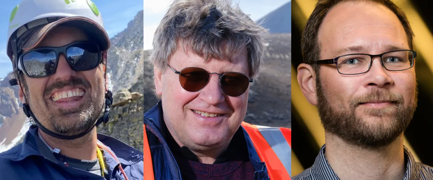
Gregory De Pascale, Þorvaldur Þórðarson and Halldór Geirsson from the University of Iceland.

The volcanic activity in Grindavík shows how crustal extension, faulting and magma work together on the boundary between the tectonic plates in Iceland

New research conducted by an international team of geologists, including scientists at the University of Iceland, sheds light on how earthquakes, rifting, and volcanic eruptions interact at the tectonic plate-boundary in Iceland. The article was published this week in the prestigious science journal Geophysical Research Letters, which is published by the American Geophysical Union.

The study, titled Dynamic coupling between faulting, rifting and magmatism during the 2021–2025 unrest on Reykjanes Peninsula, Iceland, is based on extensive monitoring of volcanic activity on the Reykjanes Peninsula from 2021 to 2025. By integrating high-resolution earthquake data, GPS and satellite measurements, field observations, and eruption data, researchers traced how the Earth’s crust stretched by nearly 4 metres over just a few years.

Authors from the University of Iceland are Gregory De Pascale, associate professor in structural geology; Þorvaldur Þórðarson, professor of volcanology and petrology; and Halldór Geirsson, professor of volcanology. The study was conducted in collaboration with scientists from the Czech Republic, France and the United States Geological Survey.

“The unrest on the Reykjanes Peninsula presents a unique opportunity to observe the processes that would otherwise only be visible in ancient rock outcroppings,” says Gregory De Pascale from the University of Iceland. “We are seeing rifting, faulting and volcanic eruptions evolving in real time on an active plate-boundary. This kind of research is key to understanding both natural hazards and how communities can respond to them.”

Icelandic geologists have, for decades, been at the forefront internationally in research on volcanic activity, plate-boundary, and the interaction between earthquakes and magma movement. The unique conditions in Iceland, where it is possible to observe active plate-boundary, earthquakes, and volcanic activity as they occur, have made the country one of the most important natural laboratories worldwide in this field.

Iceland sits on the boundary between two tectonic plates, where the Earth’s crust slowly extends, causing earthquakes, rifting and volcanic eruptions. On the Reykjanes Peninsula, this unrest resumed after a nearly 800-year hiatus, providing a rare opportunity to observe in real time the connection between faulting, surface deformation and magma movement.

Strike-slip faulting earthquakes came first – then the extension

One of the most interesting results of the study is that the first earthquakes during the largest unrest on the Reykjanes Peninsula were strike-slip earthquakes, in which the tectonic plates shifted horizontally past each other. These were followed by normal-faulting earthquakes and crustal stretching, which caused extensive fractures and ground subsidence.

“For the first time, this clearly shows that strike-slip faulting can trigger the crustal stretching, which then causes the largest surface fractures,” says Gregory. “In fact, the strike-slip faulting seems to have triggered the process before the stretching took over.”

Further, the research shows that surface fractures and faulting correlated closely with earthquakes at depth. This indicates a strong coupling between movements in the earth’s crust and the deformation that became visible in Grindavík when the graben formed in the autumn of 2023.
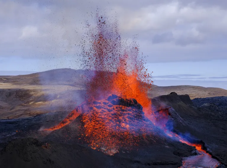
A picture of the volcanic eruption in Geldingadalir 2021.

Magma found an easier path to the surface

The research team drew on international expertise in the study of plate-boundaries, earthquakes, and volcanic activity, and based its work in part on measurements from a dense seismic network installed on the Reykjanes Peninsula by collaborators from the Czech Republic.

“A network of 15 seismic stations, which we call REYKJANET, was installed in 2013 and upgraded in 2016 to record earthquakes in real time. The network was designed for high-resolution measurements of earthquakes and the fractures they generate, and it provided the first high-resolution data on the unrest between 2021 and 2025 — key observations from the first volcanic unrest in the area in nearly 800 years,” says the paper’s lead author, Tomas Fischer, professor at Charles University.

The researchers found that as the unrest evolved, earthquake swarms became weaker and provided increasingly shorter warning times before eruptions. This suggests that over time, the magma found easier pathways through fracture systems formed during earlier episodes of unrest.

The first swarm in 2021, which led to the Geldingadalir eruption, released by far the most energy. At that time, the Earth’s crust fractured for the first time in nearly 800 years without volcanic unrest in the region, attracting attention not only in Iceland but worldwide. Later events produced smaller earthquakes, although rifting and eruptions could still be extensive.

In autumn 2023, the activity shifted to the Svartsengi area and Grindavík. This phase saw the greatest crustal spreading, reaching up to 2.5 metres at its maximum, as the Sundhnúkur crater row and the Grindavík fault system were reactivated.

Long-term plate spreading the main driving force

According to Þorvaldur Þórðarson, the findings indicate that the primary cause of the unrest is the continuous spreading of the tectonic plate-boundary beneath Iceland.

“Long-term movements of the Earth’s tectonic plates are the main driving force,” says Þorvaldur. “Stress gradually builds up across the plate-boundary until the crust gives way. If magma accumulates at the same time, it can exploit the fractures to flow toward the surface and trigger an eruption.”

He says the unrest on the Reykjanes Peninsula also underscores the importance of collecting high-quality data while events are unfolding.

“Data of this kind will be invaluable for future research, long after current interpretations of the data have evolved or changed,” says Þorvaldur.

Important for hazard forecasting

The results are also important for hazard assessment and contingency planning due to eruptions and earthquakes. The study shows that there’s no correlation between erupted magma volume, seismicity, and crust extension.

This underlines how complex the interactions between magma, faulting and extension can be on a plate-boundary like the one beneath Iceland.

The article was published in Geophysical Research Letters and can be accessed here.

Gregory De Pascale, Þorvaldur Þórðarson and Halldór Geirsson from the University of Iceland.
Authors from the University of Iceland are Gregory De Pascale, associate professor in structural geology, Þorvaldur Þórðarson, professor of volcanology and petrology, and Halldór Geirsson, professor of volcanology.

Share

Tags
Did this help?

Why wasn't this information helpful

Limit to 250 characters.