Aðalbygging
The Aula
- Free admission
Doctoral candidate:
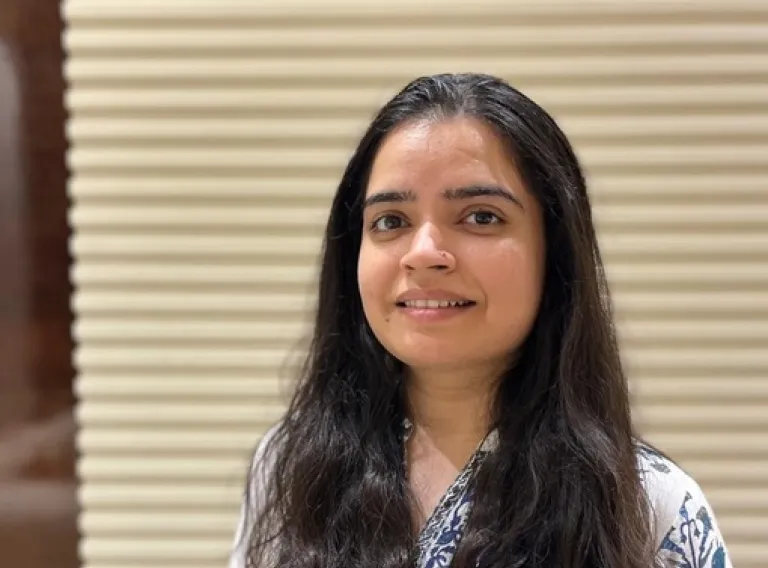
Surbhi Sharma
Title of thesis:
Advancing Land-Cover and Land-Use Classification with Semantically Consistent and Data-Efficient Deep Learning on Multi-Source Earth Observation Data
Opponents:
Dr. Vito Pascazio, Professor of Telecommunications, Università degli Studi di Napoli, Italy
Dr. Gülşen Taşkın Kaya, Associate Professor, Institute of Disaster Management, Istanbul Technical University, Turkey
Advisor:
Dr. Morris Riedel, Professor at the Faculty of Industrial Engineering, Mechanical Engineering, and Computer Science, University of Iceland
Other members of the doctoral committee:
Dr. Gabriele Cavallaro, Associate Professor at the Faculty of Electrical and Computer Engineering, University of Iceland
Dr. Claudia Paris, Assistant Professor at the Faculty of Geo-information Science and Earth Observation, University of Twente, The Netherlands
Chair of Ceremony:
Dr. Sigrún Nanna Karlsdóttir, Professor at the Faculty of Industrial Engineering, Mechanical Engineering and Computer Science
Abstract:
Land-use and Land-cover (LULC) mapping from Earth Observation (EO) imagery plays a fundamental role in environmental monitoring, urban planning, agricultural management, and climate change assessment. Recent advances in satellite missions, Machine Learning (ML), Deep Learning (DL), and foundation models have significantly improved large-scale mapping capabilities. However, important challenges remain, including semantic inconsistencies between satellite imagery and in-situ observations, the lack of large-scale benchmark datasets with detailed LULC information for training and evaluating advanced DL models, heterogeneous data sources, mixed pixel effects, limited availability of annotated training data, and the need for computationally scalable processing frameworks. Addressing these challenges requires methodologies that integrate multiple data modalities while improving semantic consistency, data efficiency, and spatial representation. This thesis presents a comprehensive framework for advancing satellite-based LULC mapping through four complementary research directions. First, it investigates the semantic relationship between satellite observations and in-situ field data by leveraging geo-tagged field photographs as an intermediate observational layer. The analysis demonstrates that apparent disagreements between satellite-derived and field-based information often arise not only from limitations of satellite observations but also from ambiguities in field interpretation and inconsistencies in land-cover (LC) taxonomies. Second, the thesis produces the Sen4Map, a large-scale benchmark dataset, integrating Sentinel-2 imagery with harmonized Land Use/Cover Area Frame Survey (LUCAS) field observations and ancillary information. The benchmark provides semantically rich annotations designed to support the development and evaluation of robust DL models for LULC mapping. Third, the thesis develops methods for sub-pixel LULC estimation to capture fine-scale landscape heterogeneity beyond the native spatial resolution of satellite imagery. As a proof of concept, the proposed framework estimates built-up fractions from Sentinel-2 imagery using geospatial foundation model embeddings, demonstrating the potential of pretrained spectral-spatial representations for sub-pixel characterization. And finally, the thesis explores data-efficient learning strategies for EO by investigating few-shot learning with meta-learning on publicly available Remote Sensing (RS) benchmark datasets. These approaches demonstrate improved generalization under limited annotation availability, reducing the dependence on extensive labeled datasets while maintaining competitive mapping performance across diverse environments. Beyond methodological advances, the thesis also contributes scalable computational solutions through a HDF5-based data architecture optimized for High-Performance Computing (HPC) environments, enabling efficient storage, access, and processing of large multi-source EO datasets. Collectively, the proposed methodologies contribute toward more semantically consistent, data-efficient, and scalable satellite-based LULC mapping systems. As EO transitions toward foundation models, unified embedding representations, and agentic geospatial intelligence, the contributions presented in this thesis establish the datasets, semantic frameworks, and embedding-centric methodologies required to support the next generation of LULC mapping.
About the doctoral candidate:
Surbhi Sharma received the B.Tech degree in electronics and communication engineering from Amity University, India, in 2015, and the M.Sc degree in Geo-information Science and Earth Observation with a specialization in Geo-informatics jointly from the Indian Institute of Remote Sensing, Indian Space and Research Organization (ISRO), India, and the Faculty of Geo-information Science and Earth Observation (ITC), University of Twente, the Netherlands, in 2018. She is a member in Simulation and Data Lab Remote Sensing (EuroCC- National Competence Center for HPC and AI in Iceland). Her research interest lies in scalable machine learning and deep learning methods for remote sensing applications, with a particular focus on advanced deep transfer learning methods using modern High Performance Computing (HPC) systems.
About events held at the University of Iceland
The content of events organised within the University of Iceland is the responsibility of the organisers, speakers, and other participants. The views, opinions, and statements expressed at such events, whether orally or in writing, are those of the individuals concerned and do not necessarily reflect the views, policies, or positions of the University of Iceland.
Share
Buses 14, 1, 6, 3 and 12 stop at the University of Iceland in Vatnsmýri. Buses 11 and 15 also stop nearby. Let's travel in an ecological way!