Research scientists at the University of Iceland's Faculty of Electrical and Computer Engineering have developed a new method to fuse remote sensing images from satellites with different resolutions, a method superior to former ones. This method is described in an article in the journal Remote Sensing recently.
Sentinel-2, a constellation of two remote sensing satellites, operated by the European Space Agencu (ESA), are part of the European Copernicus programme, launched in June 2015 and March 2017. These satellites are equipped with a multi-spectral sensor with 13 bands, sensitive to light from the visible, infra-red and short-wave infra-red parts of the electromagnetic spectrum. Of these 4 bands have a 10 m resolution, 6 20 m resolution and 3 have a 60 m resolution. The different resolutions of the sensor can be attributed to factors connected to physics and engineering.
To increase the utility of the images for a variety of remote sensing projects, e.g. the classification and analyses of changes in geographical features over time, it is ideal to have all images at a resolution of 10 m, since the images are different depending on the wavelengths of each band. This problem, i.e. the fusion of images with differing resolutions and spectral qualities, is not new in remote sensing, however, what makes this project interesting is that the various bands of Sentinel-2 do not overlap on the spectrum; increasing the challenge faced.
In recent years Frosti Pálsson, postdoc at the Faculty of Electrical and Computer Engineering, has worked on research on image fusion in remote sensing alongside his supervisors, Jóhannes R. Sveinsson and Magnús Ö. Úlfarsson - both professors at the faculty. Recently they published an article in the journal Remote Sensing where they present a new method in sharpening or fusion of Sentinel-2 images based on deep learning. The research is part of a project supported by Rannís, the Icelandic Centre for Research, called "Deep Learning and Big Data in Remote Sensing".
This new method makes it possible to increase the spatial resolution of 20 m and 60 m resolution images to 10 resolution, without visible distortion to the spectral data in the images. The article compares the method to the methods currently considered best in field, and it proves to yield better results than formerly achieved.
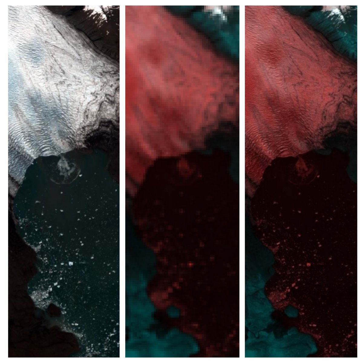
The image accompanying the article was taken by the Sentinel-2B satellite last April, and it shows where a large piece has broken from the edge of Breiðamerkurjökull Glacier and fallen into the Jökulsárlón Lagoon. The wave that has formed and spread in the lagoon can be detected. The image furthest to the left is a colour image processed from the 10 m bands, the image in the middle is in fake colours and shows the 60 m bands, and the image to the right then shows the 60 m bands after they have been sharpened using the new method. The sharpened bands now have the same spatial resolution as the 10 m bands, and thus their utility is increased dramatically.


